
1948 Map of Hagemeister Island D-3
USGS Topo · Published 1957About this map
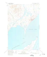
Hagemeister Strait serves as the focal point of this coastal survey, separating the northern tip of Hagemeister Island from the mainland at the edge of Togiak Bay. The map captures a largely unpopulated maritime landscape defined by its coastal landmarks, including the prominent Tongue Point and the elevations of Aeolus Mtn. Interior water systems like the Matogak River and Quigmy River are shown meandering through low-lying coastal terrain before emptying into the larger waters of Bristol Bay. This 1948 topographic record, based on aerial photography from the mid-1940s, highlights the isolation of the Alaska coastline, where navigation and geography are dictated by points such as Rocky Point and the shifting tidal flats at river mouths.
Find a feature on this map
9 named features on this map. Tap any name to fly to it.
Don’t see what you’re looking for? This feature index may not catch every label — zoom into the map to look around manually.
Map Details
Editions of this 1948 Hagemeister Island D-3 Map
2 editions found
Other maps of this area

1947 · Hagemeister Island D-2
USGS Topo · 1:63,360

1948 · Hagemeister Island C-4
USGS Topo · 1:63,360

1948 · Hagemeister Island C-3
USGS Topo · 1:63,360
1948 · Hagemeister Island C-2
USGS Topo · 1:63,360

1951 · Goodnews
USGS Topo · 1:250,000

1951 · Hagemeister Island
USGS Topo · 1:250,000

1952 · Hagemeister Island C-3
USGS Topo · 1:63,360

1952 · Hagemeister Island C-2
USGS Topo · 1:63,360

1952 · Hagemeister Island C-4
USGS Topo · 1:63,360

1953 · Hagemeister Island D-2
USGS Topo · 1:63,360