
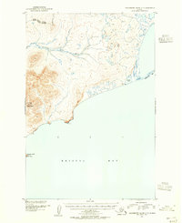
1948 Map of Hagemeister Island C-4
USGS Topo · Published 1974About this map
Hagemeister Island dominates this mid-century maritime study, showcasing the stark coastal geography of the Bristol Bay region. Surveyed by the U. S. Coast and Geodetic Survey using aerial photography from 1948, the map documents the shifting shoreline where Hagemeister Strait meets the open water. The island's western edge is defined by significant deposits of Mud and Sand and the prominent protrusion of Asigyukpak Spit. To the south, the land terminates at Calm Point, a critical coastal landmark for navigation in these waters. This survey provides a baseline of the island's uninhabited terrain and hydrography before the minor revisions of the early 1970s, serving as a primary record of the topographic and inshore detail for the Dillingham area during the post-war era.
Find a feature on this map
6 named features on this map. Tap any name to fly to it.
Don’t see what you’re looking for? This feature index may not catch every label — zoom into the map to look around manually.
Map Details
Editions of this 1948 Hagemeister Island C-4 Map
This is the sole edition of this map. No revisions or reprints were ever made.
Other maps of this area

1948 · Hagemeister Island D-3
USGS Topo · 1:63,360

1948 · Hagemeister Island C-3
USGS Topo · 1:63,360

1948 · Hagemeister Island C-5
USGS Topo · 1:63,360

1950 · Hagemeister Island D-5
USGS Topo · 1:63,360

1951 · Hagemeister Island
USGS Topo · 1:250,000

1952 · Hagemeister Island C-3
USGS Topo · 1:63,360
1952 · Hagemeister Island C-5
USGS Topo · 1:63,360

1952 · Hagemeister Island C-4
USGS Topo · 1:63,360

1954 · Hagemeister Island D-5
USGS Topo · 1:63,360

1954 · Hagemeister Island D-4
USGS Topo · 1:63,360