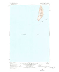
1953 Map of Hagemeister Island D-2
USGS Topo · Published 1955About this map
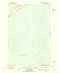
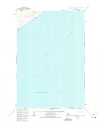
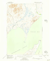
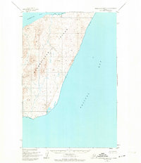
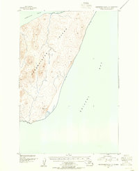
Togiak Bay and the vast expanse of Bristol Bay dominate this 1953 hydrographic and topographic survey. The coastal landscape is characterized by the mouth of the Quigmy R in the northwestern corner, where steep terrain rises sharply from the shoreline. To the south, High Island stands as a solitary landmark within the open waters, providing a critical reference point for navigation in this subarctic maritime environment. Based on aerial photography from 1947 and hydrography from the U.S. Coast and Geodetic Survey, the map illustrates the remote character of this Alaskan coastline before significant modern development, focusing on the essential relationship between the tidal waters and the immediate shore.
Find a feature on this map
4 named features on this map. Tap any name to fly to it.
Don’t see what you’re looking for? This feature index may not catch every label — zoom into the map to look around manually.
Map Details
Editions of this 1953 Hagemeister Island D-2 Map
This is the sole edition of this map. No revisions or reprints were ever made.
Other maps of this area
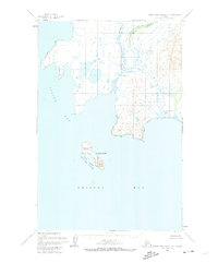
1947 · Hagemeister Island D-2
USGS Topo · 1:63,360
1948 · Hagemeister Island D-3
USGS Topo · 1:63,360
1948 · Hagemeister Island C-3
USGS Topo · 1:63,360
1948 · Hagemeister Island C-2
USGS Topo · 1:63,360

1948 · Hagemeister Island C-1
USGS Topo · 1:63,360
1950 · Hagemeister Island D-1
USGS Topo · 1:63,360

1951 · Goodnews
USGS Topo · 1:250,000
1951 · Hagemeister Island
USGS Topo · 1:250,000
1952 · Hagemeister Island C-1
USGS Topo · 1:63,360
1952 · Hagemeister Island C-3
USGS Topo · 1:63,360