1948 Map of Hagemeister Island D-3
USGS Topo · Published 1975About this map
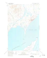
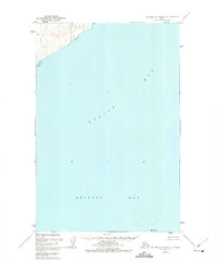
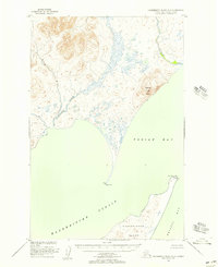
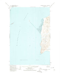
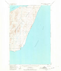
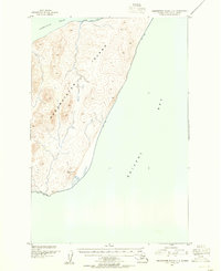
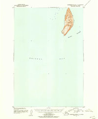
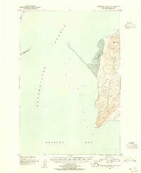
Matogak River and Quigmy River dominate the northern landscape of this coastal survey, where the winding watercourses drain into the protected waters of Togiak Bay. Based on aerial photographs from the mid-1940s, the map illustrates a remote coastal environment defined by high relief and maritime landmarks. The prominent summit of Aeolus Mtn stands as a navigational sentinel over the northern shore, while across the Hagemeister Strait, the northern portion of Hagemeister Island is charted with its coastal features, including the distinct formations at Tongue Point and Rocky Point. The lack of roads or trails on the mainland reflects the reliance on marine and riverine travel in this part of southwestern Alaska. Hydrographic data from the U.S. Coast and Geodetic Survey provides a look at the shoreline before minor revisions were made in the 1970s.
Find a feature on this map
9 named features on this map. Tap any name to fly to it.
Don’t see what you’re looking for? This feature index may not catch every label — zoom into the map to look around manually.
Map Details
Editions of this 1948 Hagemeister Island D-3 Map
2 editions found
Other maps of this area
1947 · Hagemeister Island D-2
USGS Topo · 1:63,360
1948 · Hagemeister Island D-3
USGS Topo · 1:63,360
1948 · Hagemeister Island C-4
USGS Topo · 1:63,360
1948 · Hagemeister Island C-3
USGS Topo · 1:63,360
1948 · Hagemeister Island C-2
USGS Topo · 1:63,360

1951 · Goodnews
USGS Topo · 1:250,000
1951 · Hagemeister Island
USGS Topo · 1:250,000
1952 · Hagemeister Island C-3
USGS Topo · 1:63,360
1952 · Hagemeister Island C-2
USGS Topo · 1:63,360
1952 · Hagemeister Island C-4
USGS Topo · 1:63,360