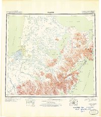
1949 Map of Ugashik
USGS Topo · Published 1949About this map
Alaska Peninsula terrain is defined by its volatile volcanic peaks and complex hydrology in this mid-century survey. The massive Becharof Lake dominates the north, feeding a network of waterways that includes the Ugashik River and the expansive Upper Ugashik Lake. Along the eastern coastline near Wide Bay, the settlement of Kanatak sits at the base of the mountains, while the remote Lee's Cabin is situated near the shore of Portage Bay. The landscape is punctuated by significant peaks like Mt Chiginagak and Mt Peulik, which overlook a wilderness of creeks and lagoons. On the western coast, Bristol Bay features landmarks such as Pilot Point and Cape Greig, marking the transition from the mountainous interior to the marshy coastal plains near the Dog Salmon River.
Find a feature on this map
79 named features on this map. Tap any name to fly to it.
Don’t see what you’re looking for? This feature index may not catch every label — zoom into the map to look around manually.
Map Details
Editions of this 1949 Ugashik Map
2 editions found
Other maps of this area

1943 · Ugashik
USGS Topo · 1:250,000

1945 · Nushagak Bay
USGS Topo · 1:250,000

1948 · Mt Katmai
USGS Topo · 1:250,000

1948 · Ugashik
USGS Topo · 1:250,000

1949 · Ugashik
USGS Topo · 1:250,000

1949 · Nushagak Bay
USGS Topo · 1:250,000

1951 · Bristol Bay
USGS Topo · 1:250,000

1951 · Trinity Islands
USGS Topo · 1:250,000

1951 · Mt Katmai
USGS Topo · 1:250,000

1951 · Karluk
USGS Topo · 1:250,000