
1963 Map of Chignik B-5
USGS Topo · Published 1967About this map
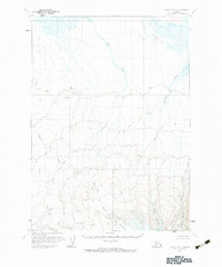
Fog Glacier and the adjacent Island Glacier dominate the southern landscape of this mid-century Alaskan survey. The area is defined by a dense network of glacial outflows and drainage systems, where Fog Creek and Fireweed Creek carve through the terrain. To the east, the Outer Glacier feeds into Blueberry Creek, illustrating the glacial dynamics of the region during the late 1950s and early 1960s. These features were mapped via photogrammetric methods from aerial photographs, revealing a wilderness devoid of roads or trails. Notable landmarks such as Thomas and the sharp drainage of Fracture Creek provide essential orientation points in this remote corner of the Chignik B-5 Quadrangle.
Find a feature on this map
11 named features on this map. Tap any name to fly to it.
Don’t see what you’re looking for? This feature index may not catch every label — zoom into the map to look around manually.
Map Details
Editions of this 1963 Chignik B-5 Map
2 editions found
Other maps of this area

1963 · Chignik A-4
USGS Topo · 1:63,360

1963 · Chignik C-4
USGS Topo · 1:63,360

1963 · Chignik A-6
USGS Topo · 1:63,360

1963 · Chignik B-4
USGS Topo · 1:63,360

1963 · Chignik B-6
USGS Topo · 1:63,360

1963 · Chignik A-5
USGS Topo · 1:63,360
1963 · Chignik C-6
USGS Topo · 1:63,360

1963 · Chignik C-5
USGS Topo · 1:63,360

1963 · Chignik
USGS Topo · 1:250,000
2020 · Chignik B-4 SW
USGS Topo · 1:25,000