Old Maps of Lucky Shot Landing, Alaska for Hiking & Exploration
Hike through history with 9 historic maps of Lucky Shot Landing. Explore old trails, ghost towns, and forgotten backroads — perfect for outdoor adventurers and local explorers.
- Rediscover forgotten places: Map out old mining camps, roads, and footpaths that no longer exist on modern maps.
- Layer with modern tools: Combine with LiDAR or satellite views to plan hikes through historical terrain.
- Made for exploration: Popular among hikers, overlanders, and local history lovers.
Use these maps to find adventure and explore the hidden past of Lucky Shot Landing.
Lucky Shot Landing, AK maps
(9)- 1949 Map of Anchorage D-7, 1961 Print
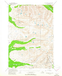
 1949 Anchorage D-71961 Print · USGSThe Talkeetna Mountains come alive in this post-war survey of Alaska's rich mining districts. Trace the high-altitude trails and operations of the Independence Mine, Gold Bullion Mine, and the route over Hatcher Pass.
 - 1951 Map of Anchorage
 1951 Anchorage1951 Print · USGSMid-century Anchorage and the Matanuska Valley are seen here during a period of rapid strategic growth. Trace the development of Fort Richardson, early rail stops at Wasilla, and established mining operations like the Independence Mine or Premier Mine.4 unique versions available
 - 1951 Map of Anchorage D-7, 1965 Print
 1951 Anchorage D-71965 Print · USGSThe Talkeetna Mountains come alive in this mid-century survey of the Willow Creek mining district during a peak era of lode extraction. Researchers can locate specific historic claims and sites including the Independence Mine, Lucky Shot Mine, and Gold Cord Mine near Hatcher Pass.3 unique versions available
 - 1952 Map of Anchorage D-7
 1952 Anchorage D-71952 Print · USGSThe Talkeetna Mountains come alive in the early fifties with a focus on the active gold mining districts of the Willow Creek area. Researchers can trace the footprints of historic operations like Independence Mine, Gold Cord Mine, and the Lucky Shot Mine along the high ridges.2 unique versions available
 - 1962 Map of Anchorage, 1966 Print
 1962 Anchorage1966 Print · USGSThe Anchorage bowl and Matanuska Valley appear in this mid-century survey during a period of significant military and industrial expansion. Researchers can trace the Alaska Railroad through Sutton and Jonesville or locate historic stops like Meekins Roadhouse and the Watertower Inn.6 unique versions available
 - 1979 Map of Anchorage, 1980 Print
 1979 Anchorage1980 Print · USGSThe Anchorage bowl and Matanuska Valley appear in the late seventies as the region's transportation and military infrastructure matured. Genealogists and historians can trace rail and road evolution through Wasilla, the Matanuska Branch line, and Jonesville.
 - 1994 Map of Anchorage D-7, 2002 Print
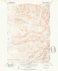
 1994 Anchorage D-72002 Print · USGSThe high peaks and gold mining districts of the Talkeetna Mountains come alive in this mid-nineties survey. Researchers can trace the road network to historic operations like the Lucky Shot Mine, Independence Mine, and the remote Marion Twin Mine.
 - 2016 Map of Anchorage D-7 SE, 2016 Print
 2016 Anchorage D-7 SE2016 Print · USGSCovers Lucky Shot Landing, including Matanuska-Susitna, United States, and other nearby areas
 - 2023 Map of Anchorage D-7 SE, 2023 Print
 2023 Anchorage D-7 SE2023 Print · USGSThe Talkeetna Mountains come alive in this 2023 survey of the region's mining and alpine history. Trace the high-country routes of the Independence Mine Trl or locate landmarks like Hatcher Pass and Summit Lake.
End of results
Showing maps 1-9 of 9
Top cities near Lucky Shot Landing
Frequently asked questions
- What are the different types of historical maps available for Lucky Shot Landing?
- What is the oldest map of Lucky Shot Landing?
- Where can I purchase historical maps of Lucky Shot Landing for my home or office?
- Where can I download high-res historical maps of Lucky Shot Landing?
- Are there historical topographic maps available for Lucky Shot Landing?
- Is there historical aerial imagery available for Lucky Shot Landing?
- Where are historical maps of Lucky Shot Landing sourced from?