
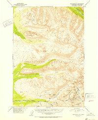
1952 Map of Anchorage D-7
USGS Topo · Published 1952About this map
Gold mining operations define the high-altitude landscape of the Talkeetna Mountains in this early 1950s survey. The concentration of mineral extraction is most evident along the southeastern ridges, where storied sites like Independence Mine and the Lucky Shot Mine are documented alongside numerous prospects such as the Marion Twin Mine and War Baby Mine. These lodes are connected by a network of high-mountain routes, including the Willow Creek Road and Hatcher Pass Road, which navigate the steep divide between the Willow Creek and Fishhook Creek drainages.
Find a feature on this map
47 named features on this map. Tap any name to fly to it.
Don’t see what you’re looking for? This feature index may not catch every label — zoom into the map to look around manually.
Map Details
Editions of this 1952 Anchorage D-7 Map
2 editions found
Other maps of this area

1949 · Anchorage D-7
USGS Topo · 1:63,360

1949 · Anchorage D-8
USGS Topo · 1:63,360

1950 · Talkeetna Mountains
USGS Topo · 1:250,000

1950 · Anchorage C-8
USGS Topo · 1:63,360

1950 · Anchorage D-6
USGS Topo · 1:63,360

1950 · Anchorage C-7
USGS Topo · 1:63,360

1950 · Talkeetna Mountains A-6
USGS Topo · 1:63,360

1950 · Talkeetna Mountains A-5
USGS Topo · 1:63,360

1951 · Anchorage
USGS Topo · 1:250,000

1951 · Anchorage C-6
USGS Topo · 1:63,360