
1950 Map of Anchorage D-6
USGS Topo · Published 1962About this map
Gold mining operations and glacial peaks dominate this high-altitude Alaskan landscape as it was documented in the early 1950s. The region is defined by a dense concentration of lode mines and prospects, such as the Snowbird Mine, Mabel Mine, and Fern Mine, which were clustered along the steep drainages feeding the Little Susitna River. This network of mineral claims reached its human hub at the Little Susitna Roadhouse, a critical stop for those traversing the rugged terrain between the northern valleys and the developing infrastructure to the south.
Find a feature on this map
33 named features on this map. Tap any name to fly to it.
Don’t see what you’re looking for? This feature index may not catch every label — zoom into the map to look around manually.
Map Details
Editions of this 1950 Anchorage D-6 Map
5 editions found
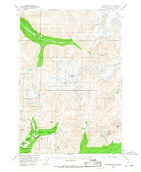
Other maps of this area

1949 · Anchorage D-5
USGS Topo · 1:63,360

1949 · Anchorage D-7
USGS Topo · 1:63,360

1949 · Talkeetna Mountains A-4
USGS Topo · 1:63,360

1950 · Talkeetna Mountains
USGS Topo · 1:250,000

1950 · Anchorage C-7
USGS Topo · 1:63,360

1950 · Talkeetna Mountains A-5
USGS Topo · 1:63,360

1951 · Anchorage
USGS Topo · 1:250,000

1951 · Anchorage C-6
USGS Topo · 1:63,360

1951 · Anchorage C-7
USGS Topo · 1:63,360

1951 · Anchorage C-5
USGS Topo · 1:63,360