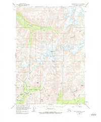
1950 Map of Anchorage D-6
USGS Topo · Published 1984About this map
High-altitude mining and rugged glacial topography dominate this 1950s-era study of the Alaska interior. The southern portion of the map is defined by a dense concentration of hard-rock prospects and active workings, including the Mabel Mine, Snowbird Mine, and Fern Mine, all accessed via the winding Fern Mine Road. These sites, alongside the Rae-Wallace Mine and Lonesome Mine, point to an era of intense mineral exploration in the Talkeetna Mountains. The landscape is carved by steep drainages like Archangel Creek and Fishhook Creek, which feed into the Little Susitna River near the Little Susitna Roadhouse. To the north, the terrain becomes increasingly dominated by ice and rock, featuring the Mint Glacier below Montana Peak. The wide valley of the Kashwitna River cuts across the upper reaches, illustrating the primary drainage patterns that shaped travel and access in this part of the Matanuska-Susitna region before widespread modern infrastructure.
Find a feature on this map
33 named features on this map. Tap any name to fly to it.
Don’t see what you’re looking for? This feature index may not catch every label — zoom into the map to look around manually.
Map Details
Editions of this 1950 Anchorage D-6 Map
5 editions found
Other maps of this area

1949 · Anchorage D-5
USGS Topo · 1:63,360

1949 · Anchorage D-7
USGS Topo · 1:63,360

1949 · Talkeetna Mountains A-4
USGS Topo · 1:63,360

1950 · Talkeetna Mountains
USGS Topo · 1:250,000

1950 · Anchorage D-6
USGS Topo · 1:63,360

1950 · Anchorage C-7
USGS Topo · 1:63,360

1950 · Talkeetna Mountains A-5
USGS Topo · 1:63,360

1951 · Anchorage
USGS Topo · 1:250,000

1951 · Anchorage C-6
USGS Topo · 1:63,360

1951 · Anchorage C-7
USGS Topo · 1:63,360