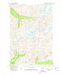
1950 Map of Anchorage D-6
USGS Topo · Published 1981About this map
Mining prospects and glaciated peaks define this mid-century portrait of the Talkeetna Mountains. The southern portion of the sheet reveals a high concentration of hard-rock mining activity centered around the upper reaches of the Little Susitna River. Here, the Archangel Road provides access to several named operations, including the Mabel Mine, Fern Mine, and Rae-Wallace Mine. This infrastructure highlights the era's focus on mineral extraction in the high country, where seasonal roadhouses like the Little Susitna Roadhouse served travelers and laborers. To the north, the landscape is dominated by the wild drainage of the Kashwitna River and the permanent ice of the Mint Glacier. The map documents a transition from the industrial activity of the southern ridges to the untracked terrain surrounding Montana Peak, providing a detailed record of the trails and claims that preceded modern development in the Matanuska-Susitna region.
Find a feature on this map
31 named features on this map. Tap any name to fly to it.
Don’t see what you’re looking for? This feature index may not catch every label — zoom into the map to look around manually.
Map Details
Editions of this 1950 Anchorage D-6 Map
5 editions found
Other maps of this area

1949 · Anchorage D-5
USGS Topo · 1:63,360

1949 · Anchorage D-7
USGS Topo · 1:63,360

1949 · Talkeetna Mountains A-4
USGS Topo · 1:63,360

1950 · Talkeetna Mountains
USGS Topo · 1:250,000

1950 · Anchorage D-6
USGS Topo · 1:63,360

1950 · Anchorage C-7
USGS Topo · 1:63,360

1950 · Talkeetna Mountains A-5
USGS Topo · 1:63,360

1951 · Anchorage
USGS Topo · 1:250,000

1951 · Anchorage C-6
USGS Topo · 1:63,360

1951 · Anchorage C-7
USGS Topo · 1:63,360