
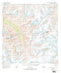
1949 Map of Talkeetna Mountains A-4
USGS Topo · Published 1966About this map
The Talkeetna Mountains define this high-altitude landscape, captured through aerial photography in the late 1940s. The map reveals a wild, roadless interior where glaciation and drainage patterns govern the topography. The headwaters of Sheep Creek cut a prominent valley through the western sections, while the eastern reaches are dominated by massive ice bodies, including the Talkeetna Glacier and the Chickaloon Glacier.
Find a feature on this map
5 named features on this map. Tap any name to fly to it.
Don’t see what you’re looking for? This feature index may not catch every label — zoom into the map to look around manually.
Map Details
Editions of this 1949 Talkeetna Mountains A-4 Map
2 editions found
Other maps of this area

1948 · Anchorage D-4
USGS Topo · 1:63,360

1949 · Anchorage D-5
USGS Topo · 1:63,360

1950 · Talkeetna Mountains
USGS Topo · 1:250,000

1950 · Talkeetna Mountains B-5
USGS Topo · 1:63,360

1950 · Talkeetna Mountains B-4
USGS Topo · 1:63,360

1950 · Anchorage D-6
USGS Topo · 1:63,360

1950 · Talkeetna Mountains A-5
USGS Topo · 1:63,360

1951 · Anchorage
USGS Topo · 1:250,000

1951 · Talkeetna Mountains B-3
USGS Topo · 1:63,360

1951 · Talkeetna Mountains A-3
USGS Topo · 1:63,360