
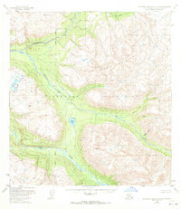
1950 Map of Talkeetna Mountains B-5
USGS Topo · Published 1959About this map
Talkeetna River headwaters dominate this mid-century survey of the Talkeetna Mountains, capturing a landscape where human presence is limited to isolated cabins along the water's edge. The complex drainage of Iron Creek and its tributaries, including East Fork and Middle Fork, reveals a high-altitude wilderness mapped just as aerial photogrammetric methods were being refined by the U.S. Geological Survey. Notable landmarks such as Wells Mountain and VABM Junto 5711 serve as primary surveying stations. The presence of Rainbow Lake and the descriptive Hyphen Gulch provides specific points of orientation for researchers tracing the early documentation of this territory before modern infrastructure reached deep into the interior. The lack of roads or trails on this sheet emphasizes the reliance on river corridors like Sheep Creek for early exploration and seasonal habitation.
Find a feature on this map
14 named features on this map. Tap any name to fly to it.
Don’t see what you’re looking for? This feature index may not catch every label — zoom into the map to look around manually.
Map Details
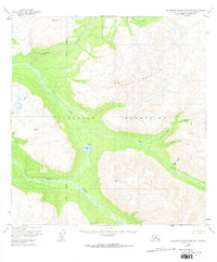
Editions of this 1950 Talkeetna Mountains B-5 Map
3 editions found
Other maps of this area

1949 · Talkeetna Mountains B-6
USGS Topo · 1:63,360

1949 · Talkeetna Mountains C-6
USGS Topo · 1:63,360

1949 · Talkeetna Mountains A-4
USGS Topo · 1:63,360

1950 · Talkeetna Mountains
USGS Topo · 1:250,000

1950 · Talkeetna Mountains B-4
USGS Topo · 1:63,360

1950 · Talkeetna Mountains A-6
USGS Topo · 1:63,360

1950 · Talkeetna Mountains A-5
USGS Topo · 1:63,360

1950 · Talkeetna Mountains C-5
USGS Topo · 1:63,360

1951 · Talkeetna Mountains C-4
USGS Topo · 1:63,360

1952 · Talkeetna Mountains C-6
USGS Topo · 1:63,360