
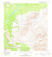
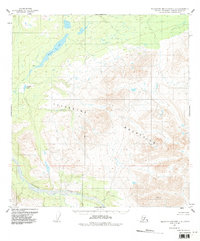
1951 Map of Talkeetna Mountains C-4
USGS Topo · Published 1965About this map
Talkeetna Mountains peaks dominate the topography of this mid-century survey, which focuses on the high-altitude drainage systems feeding the Talkeetna River to the south. The landscape is characterized by a series of alpine lakes, most notably Stephan Lake and the smaller Daneka Lake to the southwest. While much of the terrain is devoid of permanent development, a single Cabin is recorded along the upper reaches of Prairie Creek, indicating the presence of seasonal trappers, hunters, or surveyors in an otherwise unpopulated mountain wilderness. The map reflects a period when the Bureau of Land Management had predetermined land lines for future administration, though the territory remained largely unsurveyed and unmarked on the ground, preserving the raw character of the Alaskan interior before modern expansion.
Find a feature on this map
6 named features on this map. Tap any name to fly to it.
Don’t see what you’re looking for? This feature index may not catch every label — zoom into the map to look around manually.
Map Details
Editions of this 1951 Talkeetna Mountains C-4 Map
3 editions found
Other maps of this area

1950 · Talkeetna Mountains
USGS Topo · 1:250,000

1950 · Talkeetna Mountains B-5
USGS Topo · 1:63,360

1950 · Talkeetna Mountains B-4
USGS Topo · 1:63,360

1950 · Talkeetna Mountains D-5
USGS Topo · 1:63,360

1950 · Talkeetna Mountains C-5
USGS Topo · 1:63,360

1951 · Talkeetna Mountains D-5
USGS Topo · 1:63,360

1951 · Talkeetna Mountains B-3
USGS Topo · 1:63,360

1951 · Talkeetna Mountains D-3
USGS Topo · 1:63,360

1951 · Talkeetna Mountains D-4
USGS Topo · 1:63,360

1951 · Talkeetna Mountains C-3
USGS Topo · 1:63,360