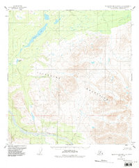
1951 Map of Talkeetna Mountains C-4
USGS Topo · Published 1987About this map
Stephan Lake and the winding course of Prairie Creek dominate the northwestern reaches of this subarctic landscape as it was documented in the early 1950s. The map illustrates a transition from the lower lake country into the high elevations of the Talkeetna Mountains, where surveying points like VABM Grebe and VABM Lima mark the prominent peaks. To the south, the Talkeetna River cuts through the terrain, serving as a primary drainage for the surrounding watershed. While the area lacks developed roads or settlements, the map provides precise topographic detail for Daneka Lake and the complex glacial landforms characteristic of the Matanuska-Susitna region. These surveys, derived from 1949 aerial photography, reflect the Bureau of Land Management's efforts to define land lines in unsurveyed territory during a period of active geographical data collection in the Alaska interior.
Find a feature on this map
7 named features on this map. Tap any name to fly to it.
Don’t see what you’re looking for? This feature index may not catch every label — zoom into the map to look around manually.
Map Details
Editions of this 1951 Talkeetna Mountains C-4 Map
3 editions found
Other maps of this area

1950 · Talkeetna Mountains
USGS Topo · 1:250,000

1950 · Talkeetna Mountains B-5
USGS Topo · 1:63,360

1950 · Talkeetna Mountains B-4
USGS Topo · 1:63,360

1950 · Talkeetna Mountains D-5
USGS Topo · 1:63,360

1950 · Talkeetna Mountains C-5
USGS Topo · 1:63,360

1951 · Talkeetna Mountains D-5
USGS Topo · 1:63,360

1951 · Talkeetna Mountains B-3
USGS Topo · 1:63,360

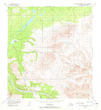
1951 · Talkeetna Mountains C-4
USGS Topo · 1:63,360

1951 · Talkeetna Mountains D-3
USGS Topo · 1:63,360

1951 · Talkeetna Mountains D-4
USGS Topo · 1:63,360