
1949 Map of Talkeetna Mountains C-6
USGS Topo · Published 1964About this map
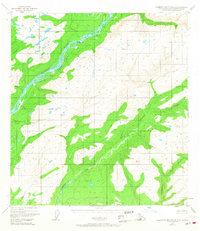
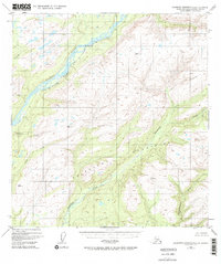
The Alaska Railroad carves a narrow path along the eastern bank of the Susitna River, serving as the primary corridor through this high-altitude landscape. Based on 1949 aerial photography, the map highlights the small settlement of Sherman as a vital waypoint in the interior. This region is defined by the massive peaks of the Talkeetna Mountains, where several vertical control stations like VABM 3631 Curry and VABM 3710 Chunila mark the high ridges. The drainage network is complex, featuring the winding courses of Troublesome Creek, Chunilna Creek, and the aptly named Disappointment Creek. The map reflects a post-war era of Alaskan development when rail was the essential link for supply and transport through the river valleys, before the expansion of modern road networks into the mountain interior.
Find a feature on this map
13 named features on this map. Tap any name to fly to it.
Don’t see what you’re looking for? This feature index may not catch every label — zoom into the map to look around manually.
Map Details
Editions of this 1949 Talkeetna Mountains C-6 Map
3 editions found
Other maps of this area

1949 · Talkeetna Mountains D-6
USGS Topo · 1:63,360

1949 · Talkeetna Mountains B-6
USGS Topo · 1:63,360

1950 · Talkeetna Mountains
USGS Topo · 1:250,000

1950 · Talkeetna
USGS Topo · 1:250,000

1950 · Talkeetna Mountains B-5
USGS Topo · 1:63,360

1950 · Talkeetna Mountains D-5
USGS Topo · 1:63,360

1950 · Talkeetna Mountains C-5
USGS Topo · 1:63,360

1951 · Talkeetna
USGS Topo · 1:250,000

1951 · Talkeetna B-1
USGS Topo · 1:63,360

1951 · Talkeetna C-1
USGS Topo · 1:63,360