
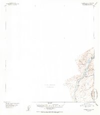
1951 Map of Talkeetna C-1
USGS Topo · Published 1951About this map
The Alaska Railroad serves as the primary artery for travel and commerce through this section of the interior, following the banks of the Susitna River. This mid-century survey captures the remote outpost of Curry, a significant stop for rail passengers, complete with a dedicated Airstrip for bush plane access. The settlement pattern is defined by isolated rail stops and small clusters such as McKenzie and Lane, which provided essential infrastructure for the railroad's operation. To the east of the tracks, the landscape is punctuated by tributaries like Portage Creek and McKenzie Creek flowing toward the main river channel. Notably, the western portion of this sheet remains blank, designated with a note for no compilation available due to insufficient photo coverage during the 1949 aerial survey.
Find a feature on this map
16 named features on this map. Tap any name to fly to it.
Don’t see what you’re looking for? This feature index may not catch every label — zoom into the map to look around manually.
Map Details
Editions of this 1951 Talkeetna C-1 Map
2 editions found
Other maps of this area

1949 · Talkeetna Mountains D-6
USGS Topo · 1:63,360

1949 · Talkeetna Mountains B-6
USGS Topo · 1:63,360

1949 · Talkeetna Mountains C-6
USGS Topo · 1:63,360

1950 · Talkeetna Mountains
USGS Topo · 1:250,000

1950 · Talkeetna
USGS Topo · 1:250,000

1951 · Talkeetna
USGS Topo · 1:250,000

1951 · Talkeetna B-1
USGS Topo · 1:63,360

1951 · Talkeetna Mountains D-6
USGS Topo · 1:63,360

1952 · Talkeetna Mountains C-6
USGS Topo · 1:63,360

1952 · Talkeetna Mountains B-6
USGS Topo · 1:63,360