
1949 Map of Talkeetna Mountains B-6
USGS Topo · Published 1962About this map
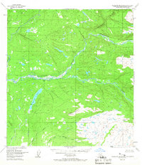
The Talkeetna River dominates this mid-century Alaskan landscape, its braided channels cutting a broad path through the interior. Photogrammetric methods from 1949 reveal a wilderness defined by water and elevation, where the drainage of Sheep Creek and Chunilna Creek converge toward the larger river system. High points like Bald Mountain and its corresponding survey station, VABM 3600 Bald Mountain, provide the primary landmarks in a region largely devoid of roads or settlements during this era. The concentration of lakes and small tributaries, such as Larson Lake and Answer Creek, suggests a complex hydrologic network in the Matanuska-Susitna region. This survey captures the territory as it was mapped by the Bureau of Land Management and the Geological Survey prior to the extensive modern development of the Alaskan backcountry.
Find a feature on this map
12 named features on this map. Tap any name to fly to it.
Don’t see what you’re looking for? This feature index may not catch every label — zoom into the map to look around manually.
Map Details
Editions of this 1949 Talkeetna Mountains B-6 Map
4 editions found
Other maps of this area

1949 · Talkeetna Mountains C-6
USGS Topo · 1:63,360

1950 · Talkeetna Mountains
USGS Topo · 1:250,000

1950 · Talkeetna
USGS Topo · 1:250,000

1950 · Talkeetna Mountains B-5
USGS Topo · 1:63,360

1950 · Talkeetna Mountains A-6
USGS Topo · 1:63,360

1950 · Talkeetna Mountains A-5
USGS Topo · 1:63,360

1950 · Talkeetna Mountains C-5
USGS Topo · 1:63,360

1951 · Talkeetna
USGS Topo · 1:250,000

1951 · Talkeetna B-1
USGS Topo · 1:63,360

1951 · Talkeetna C-1
USGS Topo · 1:63,360