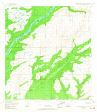
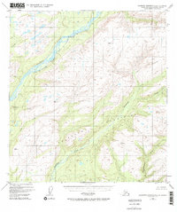
1949 Map of Talkeetna Mountains C-6
USGS Topo · Published 1968About this map
The Alaska Railroad cuts a thin line of industrial access through the western edge of this landscape, following the course of the Susitna River. This corridor represents the primary artery of travel in the region during the mid-century, connecting the small settlement of Sherman to the broader Alaskan interior. The map reveals the intricate drainage patterns of the Talkeetna Mountains, where numerous waterways like Chunilna Creek and Deadhorse Creek carve through the high terrain.
Find a feature on this map
13 named features on this map. Tap any name to fly to it.
Don’t see what you’re looking for? This feature index may not catch every label — zoom into the map to look around manually.
Map Details
Editions of this 1949 Talkeetna Mountains C-6 Map
3 editions found
Other maps of this area

1949 · Talkeetna Mountains D-6
USGS Topo · 1:63,360

1949 · Talkeetna Mountains B-6
USGS Topo · 1:63,360

1949 · Talkeetna Mountains C-6
USGS Topo · 1:63,360

1950 · Talkeetna Mountains
USGS Topo · 1:250,000

1950 · Talkeetna
USGS Topo · 1:250,000

1950 · Talkeetna Mountains B-5
USGS Topo · 1:63,360

1950 · Talkeetna Mountains D-5
USGS Topo · 1:63,360

1950 · Talkeetna Mountains C-5
USGS Topo · 1:63,360

1951 · Talkeetna
USGS Topo · 1:250,000

1951 · Talkeetna B-1
USGS Topo · 1:63,360