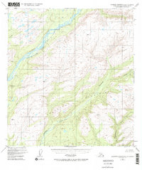
1949 Map of Talkeetna Mountains C-6
USGS Topo · Published 1986About this map
The Susitna River serves as the dominant geographic spine of this 1949 survey, carving a path through the massive Talkeetna Mountains landscape. Along its eastern bank, the Alaska Railroad provides the primary corridor for human activity and transport, marked by specific distance indicators like Mile 260 and Mile 258. The settlement at Sherman represents one of the few named outposts in this expansive terrain, situated near where the tracks intersect the river valley.
Find a feature on this map
20 named features on this map. Tap any name to fly to it.
Don’t see what you’re looking for? This feature index may not catch every label — zoom into the map to look around manually.
Map Details
Editions of this 1949 Talkeetna Mountains C-6 Map
3 editions found
Other maps of this area

1949 · Talkeetna Mountains D-6
USGS Topo · 1:63,360

1949 · Talkeetna Mountains B-6
USGS Topo · 1:63,360

1949 · Talkeetna Mountains C-6
USGS Topo · 1:63,360

1950 · Talkeetna Mountains
USGS Topo · 1:250,000

1950 · Talkeetna
USGS Topo · 1:250,000

1950 · Talkeetna Mountains B-5
USGS Topo · 1:63,360

1950 · Talkeetna Mountains D-5
USGS Topo · 1:63,360

1950 · Talkeetna Mountains C-5
USGS Topo · 1:63,360

1951 · Talkeetna
USGS Topo · 1:250,000

1951 · Talkeetna B-1
USGS Topo · 1:63,360