Old Maps of Kokruagarok, Alaska for Academic Research
Study the evolution of Kokruagarok with 6 high-resolution historic maps. Whether you're teaching, researching, or modeling changes in land use, these maps provide essential visual documentation of urban, environmental, and geographic change.
- Analyze long-term change: Track patterns in development, transportation, and natural features.
- Ideal for environmental or urban studies: Support academic projects with primary historical map data.
- Use in the classroom or lab: Educators and researchers rely on these maps to bring historical context to life.
These maps are a powerful tool for teaching, research, and visualizing how Kokruagarok has changed over the decades.
Kokruagarok, AK maps
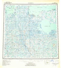
(6)- 1951 Map of Teshekpuk
 1951 Teshekpuk1951 Print · USGSThe North Slope of Alaska appears as a vast network of Arctic waterways and research outposts in the early fifties. Genealogists and historians can trace isolated sites like Half Moon Three Ranch and the early Oil Seep near Cape Simpson.
 - 1955 Map of Teshekpuk, 1962 Print
 1955 Teshekpuk1962 Print · USGSThe Arctic coastal plain comes into focus in the mid-fifties, showing a landscape of permafrost lakes and early petroleum exploration. Researchers can locate remote energy sites like the Simpson Test Well and isolated markers such as Alaktak or the Lonely Aerodrome.5 unique versions available
 - 1955 Map of Teshekpuk D-1, 1970 Print
 1955 Teshekpuk D-11970 Print · USGSThe Beaufort Sea coast and the vast thaw lakes of the North Slope are captured in the mid-1950s. Researchers can trace remote sites like Kokruagarok, the abandoned Kolovik (Aban'd), and the infrastructure at Lonely.
 - 1964 Map of Teshekpuk
 1964 Teshekpuk1964 Print · USGSThe Arctic coastline and the expansive Teshekpuk Lake are captured here during the mid-twentieth century. Researchers can trace remote cabins, the Winter Trail, and early aviation sites like the Lonely Aerodrome across the tundra.
 - 2016 Map of Teshekpuk D-1 NE, 2016 Print
 2016 Teshekpuk D-1 NE2016 Print · USGSCovers Kokruagarok, including North Slope, United States, and other nearby areas
 - 2020 Map of Teshekpuk D-1 NE, 2020 Print
 2020 Teshekpuk D-1 NE2020 Print · USGSThe North Slope coastline meets the Arctic waters of the Beaufort Sea in this modern survey. Researchers can locate the Lonely Air Station and trace the winding course of the Smith River near Pitt Point.
End of results
Showing maps 1-6 of 6
Frequently asked questions
- What are the different types of historical maps available for Kokruagarok?
- What is the oldest map of Kokruagarok?
- Where can I purchase historical maps of Kokruagarok for my home or office?
- Where can I download high-res historical maps of Kokruagarok?
- Are there historical topographic maps available for Kokruagarok?
- Is there historical aerial imagery available for Kokruagarok?
- Where are historical maps of Kokruagarok sourced from?