Old Maps of North Slope, Alaska
Explore 2,566 old maps of North Slope, spanning from 1945 to today. These high-resolution historic maps reveal how streets, neighborhoods, landmarks, and natural features evolved over time — perfect for genealogy, metal detecting, research, and local history exploration.
What you can do with these maps:
- See how North Slope changed over time: Compare historical maps to modern-day views to trace roads, homesites, rail lines & more.
- View detailed metadata: Each map includes creators, publishers, year, scale, and archive source.
- Overlay maps with satellite & LiDAR: Visualize the past alongside modern tools to explore terrain & human change.
- Trusted historical sources: Maps sourced from the USGS, Library of Congress, and other archives.
- Access maps your way: View online, download high-res files, or order prints for personal or research use.
Start exploring old maps of North Slope to uncover forgotten places, hidden landmarks, and the deep history beneath your feet.
North Slope, AK maps
(2,566)- 1945 Map of Barrow, 1954 Print
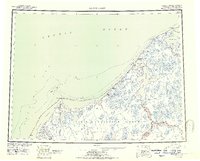
 1945 Barrow1954 Print · USGSThe northernmost tip of Alaska is captured here in the mid-1940s as the region became a focus for naval energy reserves. Researchers can locate the village of Nuwuk, the strategic Barrow Airfield, and the Will Rogers and Wiley Post Memorial.
 - 1949 Map of Barrow
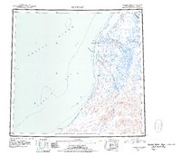
 1949 Barrow1949 Print · USGSThe northernmost edge of the continent is captured in the late 1940s, showing the early infrastructure of the North Slope. Researchers can locate Barrow and Nuwuk, trace the Plover Islands chain, and find the Will Rogers and Wiley Post Memorial.2 unique versions available
 - 1951 Map of De Long Mountains
 1951 De Long Mountains1951 Print · USGSThe Arctic coast and Brooks Range appear in this early postwar survey as a landscape of massive river systems and unnamed peaks. Researchers can trace the path of the Winter Trail near Cape Sabine or locate the remote Thetis Mine and Igloo Mtn.
 - 1951 Map of Harrison Bay
 1951 Harrison Bay1951 Print · USGSThe North Slope of Alaska during the early postwar period reveals a wilderness of massive river deltas and federal petroleum reserves. Researchers can trace the remote waterways of the Colville River and find isolated landmarks like the Trading Post and Ocean Point.
 - 1951 Map of Utukok River
 1951 Utukok River1951 Print · USGSThe North Slope of Alaska appears as a vast network of Arctic waterways and federal energy lands during the early fifties. Researchers can trace the braided paths of the Utukok River and Ketik River as they flow through the Naval Petroleum Reserve No 4.
 - 1951 Map of Meade River
 1951 Meade River1951 Print · USGSThe North Slope coast and interior river systems are captured here in the early fifties during an era of intensified arctic exploration. You can locate the small settlement of Atkasuk, a nearby Coal Mine, and various Cabins along the banks of the Meade River.
 - 1951 Map of Wainwright
 1951 Wainwright1951 Print · USGSCoastal life along the Chukchi Sea is captured here during the early 1950s, showing the intersection of traditional settlements and federal reserve lands. Researchers can trace the location of several abandoned sites like Atanik and Akoonik or the early industrial footprint of the Coal Mine.
 - 1951 Map of Lookout Ridge
 1951 Lookout Ridge1951 Print · USGSAlaska's North Slope is captured in the early fifties during an era of strategic resource exploration within the Naval Petroleum Reserve No 4. Researchers can trace the complex drainage of the Meade River and find landmarks like Birthday Pass and Lookout Ridge.
 - 1951 Map of Beechey Point
 1951 Beechey Point1951 Print · USGSThe North Slope coast is captured here just after the war, showing the wild river deltas and barrier islands of the Arctic. Trace the natural flow of the Sagavanirktok River and locate coastal landmarks like Beechey Point and Prudhoe Bay before their industrial transformation.
 - 1951 Map of Point Lay
 1951 Point Lay1951 Print · USGSThe Arctic coast near Point Lay in the early fifties was a landscape of barrier islands and massive lagoons. Researchers can trace seasonal routes like the Winter Trail and locate remote outposts such as Naokok and the Point Lay settlement.2 unique versions available
 - 1951 Map of Barter Island
 1951 Barter Island1951 Print · USGSThe Arctic coastline of Alaska's North Slope appears in the early 1950s as a stretch of barrier islands and isolated river deltas. Trace early coastal outposts and maritime landmarks like Teddy Bear Hbr, Arey Island, and the mouth of the Jago River.
 - 1951 Map of Sagavanirktok D-5
 1951 Sagavanirktok D-51951 Print · USGSAlaska's North Slope in the early fifties remains a wilderness of braided rivers and unmapped peaks during this naval petroleum survey. Researchers can trace the complex courses of the Sagavanirktok River and Ivishak River as they flow out of the Franklin Mountains.
 - 1951 Map of Teshekpuk
 1951 Teshekpuk1951 Print · USGSThe North Slope of Alaska appears as a vast network of Arctic waterways and research outposts in the early fifties. Genealogists and historians can trace isolated sites like Half Moon Three Ranch and the early Oil Seep near Cape Simpson.
 - 1951 Map of Ikpikpuk River
 1951 Ikpikpuk River1951 Print · USGSThe North Slope at mid-century is captured here as a sprawling network of tundra lakes and arctic waterways within the Naval Petroleum Reserve No 4. Researchers can trace the winding Ikpikpuk River or locate the remote Colville Bar Landing Area and Starfish Bluff.
 - 1951 Map of Demarcation Point
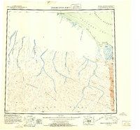 1951 Demarcation Point1951 Print · USGSThe northernmost edge of the Alaskan frontier meets the Canadian border in the early 1950s, showing a land defined by massive coastal lagoons and high mountain passes. Researchers can trace the remote settlement of Gordon or follow the paths of the Kongakut River and Jago River into the Brooks Range.4 unique versions available
 - 1951 Map of Chandler Lake, 1952 Print
 1951 Chandler Lake1952 Print · USGSThe Alaskan interior across the Brooks Range is captured here in the early fifties, showing a remote landscape defined by its rivers and peaks. Researchers can trace the drainage of the Anaktuvuk River and locate vital mountain crossings like Anaktuvuk Pass.
 - 1951 Map of Chandalar, 1952 Print
 1951 Chandalar1952 Print · USGSThe Brooks Range interior comes into focus in the early fifties, documenting a landscape of mining camps and river headwaters. Trace the legacy of gold prospectors through labels for the Beaver-Caro Wagon Road, the settlement of Caro, and the Gold Landing Strip.
 - 1951 Map of Howard Pass, 1952 Print
 1951 Howard Pass1952 Print · USGSThe North Slope of the Brooks Range appears in this early postwar survey as a landscape of strategic importance and remote waterways. Researchers can trace the vast Naval Petroleum Reserve No 4 and the many headwaters around Howard Pass and Feniak Lake.
 - 1951 Map of Brooks, 1952 Print
 1951 Brooks1952 Print · USGSThe northern Alaskan interior was still being mapped by air in the mid-twentieth century, revealing a landscape of high summits and winding river valleys. Trace the remote headwaters of the Sagavanirktok River and the peaks of the Philip Smith Mountains.
 - 1951 Map of Misheguk Mountain, 1952 Print
 1951 Misheguk Mountain1952 Print · USGSThe North Slope interior and the western Brooks Range are documented here in the early postwar era. Researchers can trace the complex Arctic drainage patterns of the Utukok River and locate remote landmarks like Meat Mountain and Rabbit Ears.
 - 1951 Map of Killik River, 1952 Print
 1951 Killik River1952 Print · USGSNorthern Alaska’s interior unfolds across the Brooks Range and Arctic Slope in the early fifties. Trace the expansive Naval Petroleum Reserve No 4 and the winding paths of the Killik River, Kurupa Lakes, and Killik Bend.
 - 1951 Map of Arctic, 1952 Print
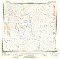
 1951 Arctic1952 Print · USGSThe northern Alaskan interior at the start of the 1950s is documented here through its rivers and isolated mountain outposts. Trace the geography of the Brooks Range and find the remote Arctic Village alongside landmarks like Old John Lake.
 - 1951 Map of Table Mountain, 1952 Print
 1951 Table Mountain1952 Print · USGSThe Brooks Range near the Canadian border is captured here in the early fifties, showing a remote wilderness of high peaks and vast river basins. Researchers can trace the Coleen River and Old Crow River or locate summits like Table Mountain.4 unique versions available
 - 1951 Map of Mt. Michelson, 1952 Print
 1951 Mt. Michelson1952 Print · USGSThe high Brooks Range meets the Arctic coast in the early 1950s, a period of naval petroleum exploration and aerial surveying. Trace the peaks of Mt Michelson and remote interior waters like Lake Schrader and the Neruokpuk Lakes.4 unique versions available
 - 1952 Map of Umiat
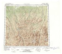
 1952 Umiat1952 Print · USGSNorth Slope exploration was in full swing during the early fifties, centered on the strategic outpost of Umiat. Researchers can trace the braided channels of the Colville River and identify remote landmarks like Sentinel Hill and Umiat Airport.
Showing maps 1-25 of 2,566
Top cities of North Slope
- Utqiaġvik historical maps
- Prudhoe Bay historical maps
- Point Hope historical maps
- Wainwright historical maps
- Anaktuvuk Pass historical maps
- Nuiqsut historical maps
See more
Frequently asked questions
- What are the different types of historical maps available for North Slope?
- What is the oldest map of North Slope?
- Where can I purchase historical maps of North Slope for my home or office?
- Where can I download high-res historical maps of North Slope?
- Are there historical topographic maps available for North Slope?
- Is there historical aerial imagery available for North Slope?
- Where are historical maps of North Slope sourced from?