Old Maps of Wainwright, Alaska
Explore 10 old maps of Wainwright, spanning from 1951 to today. These high-resolution historic maps reveal how streets, neighborhoods, landmarks, and natural features evolved over time — perfect for genealogy, metal detecting, research, and local history exploration.
What you can do with these maps:
- See how Wainwright changed over time: Compare historical maps to modern-day views to trace roads, homesites, rail lines & more.
- View detailed metadata: Each map includes creators, publishers, year, scale, and archive source.
- Overlay maps with satellite & LiDAR: Visualize the past alongside modern tools to explore terrain & human change.
- Trusted historical sources: Maps sourced from the USGS, Library of Congress, and other archives.
- Access maps your way: View online, download high-res files, or order prints for personal or research use.
Start exploring old maps of Wainwright to uncover forgotten places, hidden landmarks, and the deep history beneath your feet.
Wainwright, AK maps
(10)- 1951 Map of Wainwright
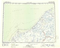 1951 Wainwright1951 Print · USGSCoastal life along the Chukchi Sea is captured here during the early 1950s, showing the intersection of traditional settlements and federal reserve lands. Researchers can trace the location of several abandoned sites like Atanik and Akoonik or the early industrial footprint of the Coal Mine.
 - 1955 Map of Wainwright, 1963 Print
 1955 Wainwright1963 Print · USGSCoastal Alaska in the mid-fifties reveals a landscape of transition along the Chukchi Sea. Researchers can trace the location of several vanished settlements like Atanik and Kilimantavi or locate the Winter Trail through the Naval Petroleum Reserve No 4.4 unique versions available
 - 1955 Map of Wainwright C-2, 1967 Print
 1955 Wainwright C-21967 Print · USGSThe Arctic coastline of the North Slope appears here in the mid-fifties, centered on the settlement of Wainwright and the vast Wainwright Inlet. Researchers can trace early infrastructure like the Winter Trail and a remote Landing Strip, alongside outposts at Ikpiligok and Akvat.2 unique versions available
 - 1955 Map of Wainwright C-3, 1971 Print
 1955 Wainwright C-31971 Print · USGSThe North Slope coastline in the mid-fifties is defined here by the meeting of the Chukchi Sea and the Arctic tundra. Researchers can trace the seasonal Winter Trail as it parallels the shore, marking the historic path for movement across the permafrost.
 - 1964 Map of Wainwright
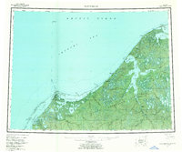
 1964 Wainwright1964 Print · USGSThe Arctic coast near the mid-twentieth century reveals a landscape of isolated outposts and maritime navigation. Genealogists and historians can trace the locations of several former settlements like Atanik and Tolageak alongside the Kuk River.
 - 2014 Map of Wainwright C-2 NW, 2014 Print
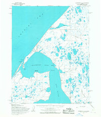
 2014 Wainwright C-2 NW2014 Print · USGSThe village of Wainwright is captured on the Arctic coast just as it appeared in the early 21st century. Researchers can trace the layout of local infrastructure from Main Street to the Wainwright Airport and the shoreline of the Wainwright Inlet.
 - 2014 Map of Wainwright C-2 NE, 2014 Print
 2014 Wainwright C-2 NE2014 Print · USGSThe North Slope coastline meets the Arctic waters in the early twenty-first century, showing a landscape of tundra and thaw lakes. Researchers can trace the winding Sinaruruk River and locate coastal points like Akvat and Ikpiligok.
 - 2014 Map of Wainwright C-2 SE, 2014 Print
 2014 Wainwright C-2 SE2014 Print · USGSThe Arctic coastline of the North Slope appears here in the early twenty-first century, showing the remote interaction of water and sky. Researchers can locate Wainwright Air Station and Tutolivik, or trace the winding paths of the Kuk River and Amagoulik Cr.
 - 2014 Map of Wainwright C-2 SW, 2014 Print
 2014 Wainwright C-2 SW2014 Print · USGSThe North Slope coastline comes into focus in this 2014 study of the intricate waterways near Maudheim. Trace the convergence of the Kuk River and Aulatauruk River as they empty into the tidal waters of Wainwright Inlet.
 - 2014 Map of Wainwright C-3 SE, 2014 Print
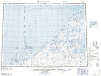
 2014 Wainwright C-3 SE2014 Print · USGSThe remote Alaskan coast and the waters of the Chukchi Sea meet in this modern survey of the Arctic tundra. Trace the unpopulated shoreline and the complex inland wetlands across the boundaries of the North Slope Borough.
End of results
Showing maps 1-10 of 10
Frequently asked questions
- What are the different types of historical maps available for Wainwright?
- What is the oldest map of Wainwright?
- Where can I purchase historical maps of Wainwright for my home or office?
- Where can I download high-res historical maps of Wainwright?
- Are there historical topographic maps available for Wainwright?
- Is there historical aerial imagery available for Wainwright?
- Where are historical maps of Wainwright sourced from?