1960s Maps of North Slope, Alaska
Explore 46 historic maps of North Slope from the 1960s. These maps offer a rare glimpse into what life looked like during the 1960s — showing old roads, neighborhoods, homes, and landmarks that have changed or disappeared over time.
Whether you're researching your family's past, planning a metal detecting trip, or studying how North Slope's landscape evolved across the 1960s, these high-resolution maps are a powerful tool for exploring the history of this region.
- Focus on a specific era: All maps on this page are from the 1960s, giving you a focused view of this time period.
- See what’s changed: Compare century-old streets, trails, and buildings to today's modern landscape using overlays and satellite layers.
- Research with precision: Use these maps for genealogy, historical research, land use analysis, or educational projects.
- View, download, or print: Maps are fully viewable online in high resolution, and can be downloaded or printed for your own records.
Start exploring North Slope's history through authentic maps from the 1960s. This is your window into the past.
North Slope, AK maps
(46)- 1960 Map of Beechey Point, 1977 Print
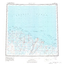 1960 Beechey Point1977 Print · USGSThe Alaska North Slope emerges in this mid-century survey as industrial infrastructure begins to take hold along the Arctic coast. Researchers can trace early developments at Deadhorse and Prudhoe Bay or locate remote coastal points like Beechey Point.3 unique versions available
 - 1962 Map of Harrison Bay C-5
 1962 Harrison Bay C-51962 Print · USGSThe North Slope landscape is captured here in the early sixties, a period of transition within the Naval Petroleum Reserve No 4. Researchers can trace the path of a Winter Trail through the tundra, past the Kogru River and an abandoned shelter cabin.
 - 1962 Map of Wainwright D-2
 1962 Wainwright D-21962 Print · USGSThe North Slope coast and the icy reaches of the Arctic appear here as they were mapped in the early sixties. Researchers can trace the shoreline at Point Belcher and follow a solitary Winter Trail through the Naval Petroleum Reserve No 4.
 - 1962 Map of Beechey Point A-1
 1962 Beechey Point A-11962 Print · USGSThe North Slope coast at the dawn of the 1960s shows a landscape of permafrost lakes and Arctic bays before major industrial expansion. You can trace early survival routes like the Tractor Trail and locate isolated outposts including a Lookout Tower and Shelter Cabins.
 - 1962 Map of Beechey Point B-2
 1962 Beechey Point B-21962 Print · USGSThe Arctic coastline and Sagavanirktok River Delta are shown here in the early 1960s, prior to major development. You can trace the pristine shoreline and offshore features like Cross Island, Anxiety Point, and Dinkum Sands.
 - 1962 Map of Meade River C-4
 1962 Meade River C-41962 Print · USGSThe North Slope landscape is captured in the mid-1950s, showing a vast wilderness of thaw lakes within the Naval Petroleum Reserve No 4. Researchers can trace the winding Inaru River and a remote Winter Trail.
 - 1962 Map of Barrow B-4
 1962 Barrow B-41962 Print · USGSThe Arctic coast at the northernmost tip of Alaska is captured here in the early sixties, showing the vital infrastructure of the North Slope. Researchers can trace the development of Barrow and Nuwuk alongside energy exploration markers like Gas Well No 4.
 - 1962 Map of Beechey Point B-1
 1962 Beechey Point B-11962 Print · USGSThe Arctic coastline and its protective barrier islands are captured in the late fifties before the region's major industrial expansion. Researchers can trace the shifting shoals of Foggy Island Bay and the exact footprints of Narwhal Island and Pole Island.
 - 1962 Map of Meade River C-5
 1962 Meade River C-51962 Print · USGSAlaska's North Slope during the early sixties reveals a landscape of tundra and strategic energy reserves. Researchers can trace the path of the Winter Trail as it crosses the Kungok River within the Naval Petroleum Reserve No 4.
 - 1962 Map of Meade River D-3
 1962 Meade River D-31962 Print · USGSThe Arctic coast near the Chukchi Sea appears in the early sixties during a period of intensive energy exploration. Historians and researchers can trace the footprint of Naval Petroleum Reserve No 4, finding early industrial markers like Skull Cliff Test Well No 1 and remote tractor trails.
 - 1962 Map of Beechey Point B-4
 1962 Beechey Point B-41962 Print · USGSThe Arctic coastline of the North Slope appears in the early sixties, years before the regional oil boom. Researchers can trace the isolated outpost at Beechey Point, the lone Warehouse, and the shifting barrier chain of the Return Islands.
 - 1962 Map of Harrison Bay C-3
 1962 Harrison Bay C-31962 Print · USGSAlaska's northern coastline and the Naval Petroleum Reserve No 4 are captured in this early 1960s coastal survey. Marine researchers and historians can trace the mid-century shoreline of Harrison Bay and the prominent Atigaru Point.
 - 1962 Map of Flaxman Island A-4
 1962 Flaxman Island A-41962 Print · USGSThe Arctic coastline of Alaska’s North Slope is captured here in the early sixties, showing the isolated barrier islands and vast river deltas of the Beaufort Sea. Researchers can trace the path of a Tractor Trail or locate the (abandoned site) on Flaxman Island.
 - 1962 Map of Flaxman Island A-5
 1962 Flaxman Island A-51962 Print · USGSCoastal Alaska in the early sixties reveals a landscape of isolated barrier islands and burgeoning Arctic infrastructure. Trace early logistics through the small boat anchorage and landing strip at Bullen Point or follow the coastal Tractor Trail.
 - 1962 Map of Harrison Bay B-1
 1962 Harrison Bay B-11962 Print · USGSThe Arctic coastline of the North Slope appears in meticulous detail in the late fifties, showing the complex braiding of the Colville River Delta. Researchers can trace the winding Kupiqruak Channel and locate coastal survey markers like VABM 10 and VABM 39.
 - 1962 Map of Harrison Bay B-2
 1962 Harrison Bay B-21962 Print · USGSThe North Slope coast comes into focus during the early sixties, showing the vast transition from tundra to the Arctic sea. Researchers can trace the shifting distributaries of the Colville River Delta and the boundaries of Naval Petroleum Reserve No 4.
 - 1962 Map of Beechey Point C-4
 1962 Beechey Point C-41962 Print · USGSThe Arctic coastline at the height of the Cold War reveals a barrier island chain protecting the mainland shore. Researchers can trace the soundings and coastal contours of Pingok Island, Bodfish Island, and the waters of Simpson Lagoon.
 - 1962 Map of Harrison Bay D-4
 1962 Harrison Bay D-41962 Print · USGSThe North Slope coast comes into focus in the early sixties, showing the intersection of the Beaufort Sea and the massive Naval Petroleum Reserve No. 4. Geologists and researchers can trace the mid-century shoreline at Cape Halkett and the soundings across Harrison Bay.
 - 1962 Map of Teshekpuk C-2
 1962 Teshekpuk C-21962 Print · USGSThe North Slope of Alaska is captured here during the early years of Arctic resource exploration, centered on the massive Teshekpuk Lake. Researchers can trace the hydrology of the Miguakiak River and locate early survey benchmarks like Vabm 18 and Bm 792.
 - 1962 Map of Meade River D-2
 1962 Meade River D-21962 Print · USGSThe North Slope landscape is captured during the mid-1950s, showing a vast tundra environment under federal management. Researchers can trace the path of the Tractor Trail and locate isolated outposts like the Cabin (abandoned) near the Inaru River.
 - 1962 Map of Beechey Point A-2
 1962 Beechey Point A-21962 Print · USGSCoastal Alaska on the North Slope comes into focus during the early sixties, showing a landscape of braided rivers and arctic tundra. Researchers can trace the Tractor Trail as it winds toward Foggy Island Bay and the mouths of the Shaviovik River.
 - 1962 Map of Barrow A-1
 1962 Barrow A-11962 Print · USGSCoastal Arctic exploration is frozen in time during the early sixties as energy interests moved into the North Slope. Researchers can trace the early petroleum industry footprint through Simpson Test Well No 1 and a remote Airstrip near Sinclair Lake.
 - 1962 Map of Demarcation Point D-3
 1962 Demarcation Point D-31962 Print · USGSThe Arctic coast at the edge of the Beaufort Sea is detailed in the early sixties, showing a landscape defined by tidal lagoons and tundra river systems. Trace the early aviation and transport routes of the North Slope through the Landing strip at Nuvagapak Point and the remote Tractor Trail.
 - 1962 Map of Meade River D-4
 1962 Meade River D-41962 Print · USGSThe North Slope coast meets the Chukchi Sea during the early 1960s within the bounds of the Naval Petroleum Reserve No 4. Researchers can trace the coastal hydrology of Peard Bay and locate isolated landmarks like a Landing strip and a remote Cabin.
 - 1962 Map of Harrison Bay B-3
 1962 Harrison Bay B-31962 Print · USGSThe Arctic North Slope in the late fifties was a landscape defined by federal reserves and seasonal paths. Researchers can trace the meandering Fish Creek and locate the Winter Trail as it crosses Naval Petroleum Reserve No 4.
Showing maps 1-25 of 46
Top cities of North Slope
- Utqiaġvik historical maps
- Prudhoe Bay historical maps
- Point Hope historical maps
- Wainwright historical maps
- Anaktuvuk Pass historical maps
- Nuiqsut historical maps
See more
Frequently asked questions
- What are the different types of historical maps available for North Slope?
- What is the oldest map of North Slope?
- Where can I purchase historical maps of North Slope for my home or office?
- Where can I download high-res historical maps of North Slope?
- Are there historical topographic maps available for North Slope?
- Is there historical aerial imagery available for North Slope?
- Where are historical maps of North Slope sourced from?