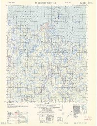
1962 Map of Beechey Point A-1
USGS Topo · Published 1962About this map
Tigvariak Island and the intricate coastal geometry of Foggy Island Bay dominate this coastal survey of the North Slope. Published in the early 1960s from mid-century photogrammetric data, the map reveals a landscape defined by water and permafrost, where the Kuparuk River and Shaviovik River meet the Beaufort Sea. Human presence is sparse but specific, marked by survival infrastructure like Shelter Cabins and a lone Lookout Tower on the coast.
Find a feature on this map
12 named features on this map. Tap any name to fly to it.
Don’t see what you’re looking for? This feature index may not catch every label — zoom into the map to look around manually.
Map Details
Editions of this 1962 Beechey Point A-1 Map
This is the sole edition of this map. No revisions or reprints were ever made.
Other maps of this area

1951 · Beechey Point
USGS Topo · 1:250,000

1951 · Sagavanirktok D-5
USGS Topo · 1:250,000

1951 · Mt. Michelson
USGS Topo · 1:250,000

1955 · Flaxman Island
USGS Topo · 1:250,000

1955 · Beechey Point
USGS Topo · 1:250,000

1955 · Mount Michelson D-5
USGS Topo · 1:63,360

1955 · Beechey Point B-2
USGS Topo · 1:63,360

1955 · Beechey Point B-1
USGS Topo · 1:63,360

1955 · Flaxman Island A-5
USGS Topo · 1:63,360

1955 · Beechey Point A-1
USGS Topo · 1:63,360