
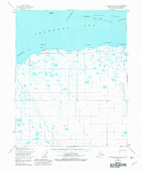
1955 Map of Flaxman Island A-5
USGS Topo · Published 1967About this map
Bullen Point serves as the primary coastal landmark on this northern Alaskan shoreline, featuring a small settlement at Bullen complete with a small boat anchorage and a landing strip. This 1955 survey illustrates the remote infrastructure of the North Slope before major industrial expansion, where travel relied on a Tractor Trail winding along the coast through Point Gordon, Point Hopson, and Point Sweeney.
Find a feature on this map
17 named features on this map. Tap any name to fly to it.
Don’t see what you’re looking for? This feature index may not catch every label — zoom into the map to look around manually.
Map Details
Editions of this 1955 Flaxman Island A-5 Map
2 editions found
Other maps of this area

1951 · Beechey Point
USGS Topo · 1:250,000

1951 · Sagavanirktok D-5
USGS Topo · 1:250,000

1951 · Mt. Michelson
USGS Topo · 1:250,000

1955 · Flaxman Island
USGS Topo · 1:250,000

1955 · Beechey Point
USGS Topo · 1:250,000

1955 · Mount Michelson D-5
USGS Topo · 1:63,360

1955 · Mount Michelson D-4
USGS Topo · 1:63,360

1955 · Beechey Point B-1
USGS Topo · 1:63,360

1955 · Beechey Point A-1
USGS Topo · 1:63,360

1955 · Flaxman Island A-4
USGS Topo · 1:63,360