
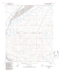
1955 Map of Mount Michelson D-4
USGS Topo · Published 1964About this map
The Arctic National Wildlife Range spans much of this landscape, encompassing the braided channels of the northern wilderness before the establishment of modern protected boundaries. In this 1955 survey, the western border of the territory is defined by the Canning River, which meanders through a network of small lakes and tundra ponds. The map captures the hydrological complexity of the North Slope, where the Staines River branches away from the primary flow toward the Arctic coast. This photogrammetric study, conducted by the Army Map Service and the Department of the Interior, provides an unfiltered view of the terrain as it appeared during the early years of modern Alaskan surveying, documenting the intricate drainage patterns and elevation contours of this remote expanse.
Find a feature on this map
3 named features on this map. Tap any name to fly to it.
Don’t see what you’re looking for? This feature index may not catch every label — zoom into the map to look around manually.
Map Details
Editions of this 1955 Mount Michelson D-4 Map
2 editions found
Other maps of this area

1951 · Mt. Michelson
USGS Topo · 1:250,000

1955 · Flaxman Island
USGS Topo · 1:250,000

1955 · Mount Michelson C-5
USGS Topo · 1:63,360

1955 · Mount Michelson C-3
USGS Topo · 1:63,360

1955 · Mount Michelson D-5
USGS Topo · 1:63,360

1955 · Mount Michelson D-3
USGS Topo · 1:63,360

1955 · Mount Michelson C-4
USGS Topo · 1:63,360

1955 · Flaxman Island A-5
USGS Topo · 1:63,360

1955 · Flaxman Island A-4
USGS Topo · 1:63,360

1955 · Flaxman Island A-3
USGS Topo · 1:63,360