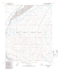
1955 Map of Mt. Michelson D-4
USGS Topo · Published 1987About this map
Canning River defines the western edge of this vast northern landscape, where the braided waterways of the North Slope meet the foothills of the Brooks Range. The 1955 photogrammetry reveals the intricate drainage patterns of the Staines River and the complex delta systems characteristic of this arctic environment. Much of the territory shown is protected within the Arctic National Wildlife Refuge, reflecting the region's status as a critical conservation area shortly after its establishment. The lack of human settlements or infrastructure emphasizes the untouched character of the terrain during this mid-century survey, providing an essential record of the natural topography before modern resource exploration intensified in the broader region.
Find a feature on this map
5 named features on this map. Tap any name to fly to it.
Don’t see what you’re looking for? This feature index may not catch every label — zoom into the map to look around manually.
Map Details
Editions of this 1955 Mt. Michelson D-4 Map
2 editions found
Other maps of this area

1951 · Mt. Michelson
USGS Topo · 1:250,000

1955 · Flaxman Island
USGS Topo · 1:250,000

1955 · Mount Michelson C-5
USGS Topo · 1:63,360

1955 · Mount Michelson C-3
USGS Topo · 1:63,360

1955 · Mount Michelson D-5
USGS Topo · 1:63,360

1955 · Mount Michelson D-3
USGS Topo · 1:63,360

1955 · Mount Michelson C-4
USGS Topo · 1:63,360

1955 · Mount Michelson D-4
USGS Topo · 1:63,360

1955 · Flaxman Island A-5
USGS Topo · 1:63,360

1955 · Flaxman Island A-4
USGS Topo · 1:63,360