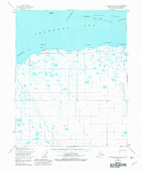
1955 Map of Flaxman Island A-5
USGS Topo · Published 1981About this map
Beaufort Sea waves meet the low-lying northern coast of Alaska in this mid-century record of the North Slope. The coastal settlement of Bullen sits near Bullen Point, marked by a tower and a small boat anchorage that served the remote maritime activity of the era. To the north, the Maguire Islands and Stockton Islands form a protective barrier for Mikkelsen Bay, with Challenge Entrance providing passage through the shifting island chain. Inland, the terrain is characterized by a dense network of thaw lakes and marshes typical of the arctic tundra. Early resource exploration is evidenced by scattered Drill Holes, while a Tractor Trail provides the primary overland connection across the frozen landscape, winding past a lone cabin near Point Hopson. This map documents a period of early industrial interest and navigational mapping along the edge of the Alaska Maritime National Wildlife Refuge.
Find a feature on this map
20 named features on this map. Tap any name to fly to it.
Don’t see what you’re looking for? This feature index may not catch every label — zoom into the map to look around manually.
Map Details
Editions of this 1955 Flaxman Island A-5 Map
2 editions found
Other maps of this area

1951 · Beechey Point
USGS Topo · 1:250,000

1951 · Sagavanirktok D-5
USGS Topo · 1:250,000

1951 · Mt. Michelson
USGS Topo · 1:250,000

1955 · Flaxman Island
USGS Topo · 1:250,000

1955 · Beechey Point
USGS Topo · 1:250,000

1955 · Mount Michelson D-5
USGS Topo · 1:63,360

1955 · Mount Michelson D-4
USGS Topo · 1:63,360

1955 · Beechey Point B-1
USGS Topo · 1:63,360

1955 · Flaxman Island A-5
USGS Topo · 1:63,360

1955 · Beechey Point A-1
USGS Topo · 1:63,360