
1955 Map of Beechey Point B-2
USGS Topo · Published 1967About this map
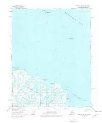
The Sagavanirktok River Delta dominates this coastal survey, where a complex network of braided channels meets the arctic waters of Foggy Island Bay. Mapped in the mid-1950s using photogrammetric methods from the Army Map Service, the landscape is defined by its shifting sands and low-lying landforms like Dinkum Sands and Howe Island. Evidence of human presence is sparse in this era, noted only by a small cluster of Cabins near Point Brower, likely used by local hunters or early explorers before the major industrial developments of the later 20th century. Farther out in the Beaufort Sea, the map charts isolated features such as Cross Island and Anxiety Point, which served as critical landmarks for early coastal navigation in a region where the shoreline and sea ice are constantly in flux.
Find a feature on this map
12 named features on this map. Tap any name to fly to it.
Don’t see what you’re looking for? This feature index may not catch every label — zoom into the map to look around manually.
Map Details
Editions of this 1955 Beechey Point B-2 Map
2 editions found
Other maps of this area

1951 · Beechey Point
USGS Topo · 1:250,000

1955 · Beechey Point
USGS Topo · 1:250,000

1955 · Beechey Point B-1
USGS Topo · 1:63,360

1955 · Beechey Point A-1
USGS Topo · 1:63,360

1955 · Beechey Point A-2
USGS Topo · 1:63,360

1955 · Beechey Point A-3
USGS Topo · 1:63,360

1955 · Beechey Point B-3
USGS Topo · 1:63,360

1960 · Beechey Point
USGS Topo · 1:250,000
1962 · Beechey Point A-1
USGS Topo · 1:50,000

1962 · Beechey Point B-2
USGS Topo · 1:50,000