1980s Maps of North Slope, Alaska
Explore 139 historic maps of North Slope from the 1980s. These maps offer a rare glimpse into what life looked like during the 1980s — showing old roads, neighborhoods, homes, and landmarks that have changed or disappeared over time.
Whether you're researching your family's past, planning a metal detecting trip, or studying how North Slope's landscape evolved across the 1980s, these high-resolution maps are a powerful tool for exploring the history of this region.
- Focus on a specific era: All maps on this page are from the 1980s, giving you a focused view of this time period.
- See what’s changed: Compare century-old streets, trails, and buildings to today's modern landscape using overlays and satellite layers.
- Research with precision: Use these maps for genealogy, historical research, land use analysis, or educational projects.
- View, download, or print: Maps are fully viewable online in high resolution, and can be downloaded or printed for your own records.
Start exploring North Slope's history through authentic maps from the 1980s. This is your window into the past.
North Slope, AK maps
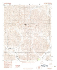
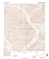
(139)- 1981 Map of Arctic B-5
 1981 Arctic B-51981 Print · USGSThe northern Alaskan wilderness is documented here in the early 1980s, showcasing a landscape defined by untouched river systems. You can trace the winding path of the Junjik River and locate remote water bodies like Timber Lake and Portage Lake.
 - 1982 Map of Teshekpuk B-2, 1987 Print
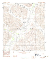
 1982 Teshekpuk B-21987 Print · USGSThe North Slope during the mid-twentieth century reveals a world of Arctic wetlands and early federal management. Trace the seasonal paths of a Winter Trail as it crosses the tundra near Teshekpuk Lake and Kealok Creek.
 - 1983 Map of Table Mountain D-2
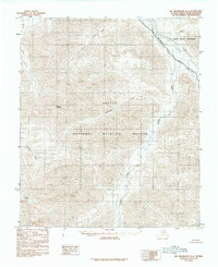
 1983 Table Mountain D-21983 Print · USGSThe northern Brooks Range and the high Arctic tundra are captured here in the early eighties. Researchers can trace the path of the Continental Divide and follow the remote courses of Mancha Creek and the Kongakut River.2 unique versions available
 - 1983 Map of Mount Michelson A-3
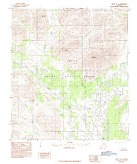
 1983 Mount Michelson A-31983 Print · USGSThe northern Brooks Range and North Slope transition through this early 1980s survey of the Brooks Range. Researchers can trace the path of the Canning River and explore the remote drainage basins of Franklin Creek and Whistle Creek.
 - 1983 Map of Table Mountain D-4
 1983 Table Mountain D-41983 Print · USGSThe northern reaches of the Brooks Range are captured here during the early eighties, showcasing a landscape untouched by roads or industry. Researchers can trace the winding Continental Divide as it cuts through the Kongakut River valley and the Arctic National Wildlife Refuge.
 - 1983 Map of Demarcation Point A-5
 1983 Demarcation Point A-51983 Print · USGSThe high Brooks Range of the early 1980s reveals a wilderness of ice and peaks along the Continental Divide. Trace the glacial reaches of Arey Glacier and the slopes of Mount Isto near the headwaters of the Jago River.
 - 1983 Map of Demarcation Point A-2
 1983 Demarcation Point A-21983 Print · USGSThe northern reaches of the Alaskan wilderness are captured here in the early eighties, showcasing a landscape of high peaks and river valleys. Researchers can trace the Kongakut River through the British Mountains and locate Mount Greenough.
 - 1983 Map of Demarcation Point A-4
 1983 Demarcation Point A-41983 Print · USGSThe North Slope interior during the early 1980s reveals a roadless wilderness defined by the Romanzof Mountains and the Continental Divide. Researchers can trace the braided Aichilik River or locate remote landmarks like Bathtub Ridge and Drain Creek.
 - 1983 Map of Table Mountain D-3
 1983 Table Mountain D-31983 Print · USGSThe Brooks Range and the far northern reaches of Alaska are captured here in the early eighties. Researchers can trace the path of the Continental Divide and the remote course of the Kongakut River through the Arctic National Wildlife Refuge.
 - 1983 Map of Mount Michelson A-1
 1983 Mount Michelson A-11983 Print · USGSThe northeastern Brooks Range is captured in the early 1980s, showcasing a landscape defined by high peaks and untouched river systems. Trace the Continental Divide across the Romanzof Mountains and follow the northern flow of the Okpilak River.2 unique versions available
 - 1983 Map of Table Mountain D-1
 1983 Table Mountain D-11983 Print · USGSThe international border between Alaska and the Yukon Territory is captured here in the early eighties as federal protections expanded. Researchers can trace the drainages of Joe Creek and Mancha Creek or identify high points like Rexburn and Siwash.
 - 1983 Map of Demarcation Point A-3
 1983 Demarcation Point A-31983 Print · USGSThe North Slope of Alaska in the early eighties remains an untouched expanse of high peaks and river systems. Researchers can trace the drainages of the Leffingwell Fork and Egaksrak River through the Romanzof Mountains.
 - 1983 Map of Mount Michelson A-2
 1983 Mount Michelson A-21983 Print · USGSThe Franklin Mountains stand in a roadless expanse of the North Slope in the early 1980s. Researchers can trace the drainage of the Hulahula River and Canning River through the protected Arctic National Wildlife Refuge.2 unique versions available
 - 1983 Map of Demarcation Point A-1
 1983 Demarcation Point A-11983 Print · USGSThe far northeastern corner of the Alaska territory meets the Canadian border in this early 1980s topographic study. Researchers can trace the drainages of Malcolm River and Joe Creek through the British Mountains and Whale Mountain.
 - 1983 Map of Arctic B-4, 1984 Print
 1983 Arctic B-41984 Print · USGSThe eastern Brooks Range foothills of the early eighties remain a roadless wilderness within the Arctic National Wildlife Refuge. Researchers can trace the winding Junjik River and locate remote peaks like Little Njoo Mountain and Misty Mountain.2 unique versions available
 - 1983 Map of Arctic C-1, 1984 Print
 1983 Arctic C-11984 Print · USGSThe remote interior of the North Slope is documented here in the early eighties, showcasing a landscape of raw drainage patterns. Researchers can trace the winding path of Old Woman Creek and the designated Wilderness Boundary within the Arctic National Wildlife Refuge.
 - 1983 Map of Arctic C-3, 1984 Print
 1983 Arctic C-31984 Print · USGSThe North Slope interior during the early eighties remains a pristine wilderness defined by the high peaks of the Brooks Range. Trace the path of the Continental Divide as it winds through the Arctic National Wildlife Refuge past Cane Creek and Flatrock Creek.
 - 1983 Map of Table Mountain C-5, 1984 Print
 1983 Table Mountain C-51984 Print · USGSThe North Slope of Alaska in the early 1980s was a landscape defined by federal preservation and ancient waterways. Researchers can trace the winding Sheenjek River past landmarks like Double Mountain and the remote Ambresuajun Lake.
 - 1983 Map of Arctic D-2, 1984 Print
 1983 Arctic D-21984 Print · USGSIn the early 1980s, the North Slope was a frontier of newly established conservation boundaries following the Alaska National Interest Lands Conservation Act. Researchers can trace the Continental Divide as it separates the Canning River and East Fork Chandalar River.2 unique versions available
 - 1983 Map of Arctic C-2, 1984 Print
 1983 Arctic C-21984 Print · USGSThe North Slope during the early eighties shows a landscape of protected wilderness before modern digital mapping. Researchers can trace the wild drainages of the East Fork Chandalar River and its tributaries like Red Sheep Creek and Old Woman Creek.2 unique versions available
 - 1983 Map of Mount Michelson A-4, 1984 Print
 1983 Mount Michelson A-41984 Print · USGSThe North Slope interior comes into focus during the early eighties, documenting the vast, roadless expanse of the Arctic National Wildlife Refuge. Researchers can trace the braided paths of the Marsh Fork Canning River and identify landmarks like Mount Salisbury.2 unique versions available
 - 1983 Map of Arctic B-3, 1984 Print
 1983 Arctic B-31984 Print · USGSAlaska's northern wilderness remains untouched in the early eighties within the Arctic National Wildlife Refuge. Researchers can trace the courses of the Junjik River and East Fork Chandalar River past Yasuda Mountain.3 unique versions available
 - 1983 Map of Table Mountain C-1, 1984 Print
 1983 Table Mountain C-11984 Print · USGSThe northern reaches of the Brooks Range meet the international border in the early eighties, showing a landscape defined by the Continental Divide. Trace the remote headwaters of the Firth River and Mancha Creek across the Arctic National Wildlife Refuge.
 - 1983 Map of Arctic D-4, 1984 Print
 1983 Arctic D-41984 Print · USGSThe North Slope wilderness remains pristine in the early eighties, centered on the Arctic National Wildlife Refuge. Researchers can trace the steep mountain drainages and complex braided channels of the Marsh Fork Canning River across this undeveloped landscape.
 - 1983 Map of Table Mountain D-5, 1984 Print
 1983 Table Mountain D-51984 Print · USGSThe North Slope Borough's interior is captured in the early eighties, showcasing the intersection of the Continental Divide and protected wilderness. Researchers can trace the winding Sheenjek River and locate the prominent peak of Double Mountain in this roadless terrain.2 unique versions available
Showing maps 1-25 of 139
Top cities of North Slope
- Utqiaġvik historical maps
- Prudhoe Bay historical maps
- Point Hope historical maps
- Wainwright historical maps
- Anaktuvuk Pass historical maps
- Nuiqsut historical maps
See more
Frequently asked questions
- What are the different types of historical maps available for North Slope?
- What is the oldest map of North Slope?
- Where can I purchase historical maps of North Slope for my home or office?
- Where can I download high-res historical maps of North Slope?
- Are there historical topographic maps available for North Slope?
- Is there historical aerial imagery available for North Slope?
- Where are historical maps of North Slope sourced from?