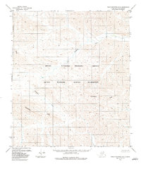
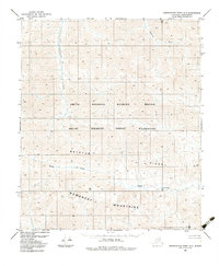
1983 Map of Table Mountain D-4
USGS Topo · Published 1983About this map
The Continental Divide winds through this high-latitude terrain, marking the fundamental hydrological separation within the Arctic National Wildlife Refuge. This 1983 survey captures a landscape defined by the drainage of the Kongakut River, which flows through expansive protected lands including the Arctic Wildlife Refuge Wilderness. Mapped by the Geological Survey via photogrammetric methods from 1973 and 1974 aerial photography, the sheet reveals a territory of extreme isolation where human infrastructure is entirely absent. The absence of roads, settlements, or established trails highlights the area's status as a primitive wilderness, dominated by the sinuous contours of the Brooks Range and the headwaters that feed into the Arctic watershed. This record is particularly valuable for understanding the pristine state of the North Slope's federal lands before modern environmental shifts or management changes.
Find a feature on this map
4 named features on this map. Tap any name to fly to it.
Don’t see what you’re looking for? This feature index may not catch every label — zoom into the map to look around manually.
Map Details
Editions of this 1983 Table Mountain D-4 Map
This is the sole edition of this map. No revisions or reprints were ever made.
Other maps of this area

1951 · Demarcation Point
USGS Topo · 1:250,000

1951 · Table Mountain
USGS Topo · 1:250,000

1955 · Demarcation Point
USGS Topo · 1:250,000

1956 · Table Mountain
USGS Topo · 1:250,000

1964 · Table Mountain
USGS Topo · 1:250,000

1964 · Demarcation Point
USGS Topo · 1:250,000
1983 · Demarcation Point A-5
USGS Topo · 1:63,360
1983 · Demarcation Point A-4
USGS Topo · 1:63,360
1983 · Table Mountain D-3
USGS Topo · 1:63,360
1983 · Demarcation Point A-3
USGS Topo · 1:63,360