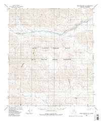
1983 Map of Table Mountain D-3
USGS Topo · Published 1983About this map
The Continental Divide dictates the flow of water across this high-latitude terrain, marking a fundamental geological boundary within the Arctic National Wildlife Refuge. Running through the southern half of the sheet, the divide separates drainage patterns in a landscape defined by dramatic elevation changes and glacial carved valleys. To the north, the Kongakut River meanders through a wide valley, serving as a primary watercourse for this protected ecosystem. This 1983 edition reflects the management of these lands following the designation of the Arctic Wildlife Refuge Wilderness, preserving a section of the Brooks Range where no roads or permanent settlements appear. The map provides a precise look at the land's contours as they were understood in the early 1980s, based on photogrammetric data from the previous decade.
Find a feature on this map
4 named features on this map. Tap any name to fly to it.
Don’t see what you’re looking for? This feature index may not catch every label — zoom into the map to look around manually.
Map Details
Editions of this 1983 Table Mountain D-3 Map
This is the sole edition of this map. No revisions or reprints were ever made.
Other maps of this area

1951 · Demarcation Point
USGS Topo · 1:250,000

1951 · Table Mountain
USGS Topo · 1:250,000

1955 · Demarcation Point
USGS Topo · 1:250,000

1956 · Table Mountain
USGS Topo · 1:250,000

1964 · Table Mountain
USGS Topo · 1:250,000

1964 · Demarcation Point
USGS Topo · 1:250,000

1983 · Table Mountain D-2
USGS Topo · 1:63,360
1983 · Table Mountain D-4
USGS Topo · 1:63,360

1983 · Demarcation Point A-2
USGS Topo · 1:63,360
1983 · Demarcation Point A-4
USGS Topo · 1:63,360