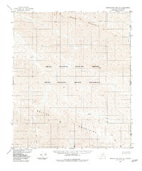
1983 Map of Demarcation Point A-1
USGS Topo · Published 1983About this map
Arctic National Wildlife Refuge lands dominate this 1983 survey along the remote international border where Alaska meets the Yukon. The landscape is defined by the high elevations of the British Mountains and Whale Mountain, which rise above a network of drainages flowing toward the Beaufort Sea. While no roads or trails are noted on the sheet, the topographical detail reveals the complex water systems of Malcolm River, Joe Creek, and Aspen Creek. This area includes the Arctic Wildlife Refuge Wilderness, representing some of the most preserved territory in the North Slope Borough. The map specifically delineates the Alaska Yukon boundary, illustrating the intersection of national and international jurisdictional lines across features like Park Peak.
Find a feature on this map
10 named features on this map. Tap any name to fly to it.
Don’t see what you’re looking for? This feature index may not catch every label — zoom into the map to look around manually.
Map Details
Editions of this 1983 Demarcation Point A-1 Map
This is the sole edition of this map. No revisions or reprints were ever made.
Other maps of this area

1951 · Demarcation Point
USGS Topo · 1:250,000

1951 · Table Mountain
USGS Topo · 1:250,000

1955 · Demarcation Point
USGS Topo · 1:250,000

1956 · Table Mountain
USGS Topo · 1:250,000

1956 · Demarcation Point B-2
USGS Topo · 1:63,360
1956 · Demarcation Point B-1
USGS Topo · 1:63,360

1964 · Table Mountain
USGS Topo · 1:250,000

1964 · Demarcation Point
USGS Topo · 1:250,000

1983 · Table Mountain D-2
USGS Topo · 1:63,360

1983 · Demarcation Point A-2
USGS Topo · 1:63,360