
1983 Map of Table Mountain D-2
USGS Topo · Published 1983About this map
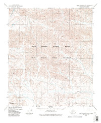
The Continental Divide traverses the southern portion of this high-latitude terrain, marking the primary hydrological boundary in this corner of the Alaska North Slope. Flowing through the northern reaches, the Kongakut River serves as a major drainage, while Mancha Creek winds through the southeastern section of the quadrangle. The entire area is contained within the Arctic National Wildlife Refuge, with a significant portion further designated as the Arctic Wildlife Refuge Wilderness. This 1983 edition represents an area with no established roads or trails, showing the land as it was surveyed through photogrammetric methods in the 1970s. The map provides a detailed record of the topography and drainage patterns at the edge of the Brooks Range before modern satellite imagery became the standard for navigation.
Find a feature on this map
5 named features on this map. Tap any name to fly to it.
Don’t see what you’re looking for? This feature index may not catch every label — zoom into the map to look around manually.
Map Details
Editions of this 1983 Table Mountain D-2 Map
2 editions found
Other maps of this area

1951 · Demarcation Point
USGS Topo · 1:250,000

1951 · Table Mountain
USGS Topo · 1:250,000

1955 · Demarcation Point
USGS Topo · 1:250,000

1956 · Table Mountain
USGS Topo · 1:250,000

1964 · Table Mountain
USGS Topo · 1:250,000

1964 · Demarcation Point
USGS Topo · 1:250,000

1983 · Demarcation Point A-2
USGS Topo · 1:63,360
1983 · Table Mountain D-3
USGS Topo · 1:63,360

1983 · Table Mountain D-1
USGS Topo · 1:63,360
1983 · Demarcation Point A-3
USGS Topo · 1:63,360