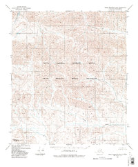
1983 Map of Table Mountain D-2
USGS Topo · Published 1983About this map
The Continental Divide traverses the southern portion of this high-latitude terrain, marking the fundamental hydrological split of the Brooks Range. In this 1983 edition, the land is designated entirely as part of the Arctic National Wildlife Refuge and the Arctic Wildlife Refuge Wilderness, reflecting the region's protected status during the late twentieth century. Drainage patterns are defined by the northward flow of the Kongakut River in the northwest and Mancha Creek further south. The map portrays a landscape devoid of permanent human settlements or roads, focusing instead on the complex contour lines and elevations that define this subarctic wilderness. It serves as a precise record of the topographical features and bureaucratic boundaries established in the North Slope Borough during this era.
Find a feature on this map
5 named features on this map. Tap any name to fly to it.
Don’t see what you’re looking for? This feature index may not catch every label — zoom into the map to look around manually.
Map Details
Editions of this 1983 Table Mountain D-2 Map
2 editions found
Other maps of this area

1951 · Demarcation Point
USGS Topo · 1:250,000

1951 · Table Mountain
USGS Topo · 1:250,000

1955 · Demarcation Point
USGS Topo · 1:250,000

1956 · Table Mountain
USGS Topo · 1:250,000

1964 · Table Mountain
USGS Topo · 1:250,000

1964 · Demarcation Point
USGS Topo · 1:250,000

1983 · Table Mountain D-2
USGS Topo · 1:63,360

1983 · Demarcation Point A-2
USGS Topo · 1:63,360
1983 · Table Mountain D-3
USGS Topo · 1:63,360

1983 · Table Mountain D-1
USGS Topo · 1:63,360