1970s Maps of North Slope, Alaska
Explore 77 historic maps of North Slope from the 1970s. These maps offer a rare glimpse into what life looked like during the 1970s — showing old roads, neighborhoods, homes, and landmarks that have changed or disappeared over time.
Whether you're researching your family's past, planning a metal detecting trip, or studying how North Slope's landscape evolved across the 1970s, these high-resolution maps are a powerful tool for exploring the history of this region.
- Focus on a specific era: All maps on this page are from the 1970s, giving you a focused view of this time period.
- See what’s changed: Compare century-old streets, trails, and buildings to today's modern landscape using overlays and satellite layers.
- Research with precision: Use these maps for genealogy, historical research, land use analysis, or educational projects.
- View, download, or print: Maps are fully viewable online in high resolution, and can be downloaded or printed for your own records.
Start exploring North Slope's history through authentic maps from the 1970s. This is your window into the past.
North Slope, AK maps
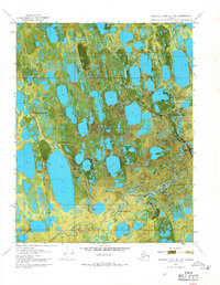
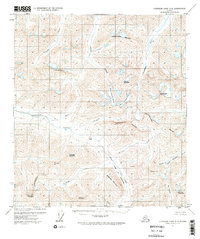
(77)- 1970 Map of Beechey Point A-4 NE, 1971 Print
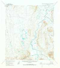
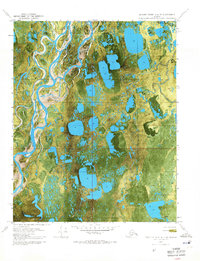 1970 Beechey Point A-4 NE1971 Print · USGSAlaska's North Slope is captured here during the early years of oil exploration, showing a landscape defined by braided rivers and frozen tundra. Researchers can trace the Winter Trail and locate early survey markers like Placid Et Al State No. 1 near the Kuparuk River.2 unique versions available
 - 1970 Map of Beechey Point B-4 SE, 1971 Print
 1970 Beechey Point B-4 SE1971 Print · USGSThe Alaskan North Slope appears in the early days of oil exploration, showing a landscape of seasonal routes and remote pads. Researchers can trace the footprint of early industrial sites like Rivers Camp Service City and the Winter Trail.2 unique versions available
 - 1970 Map of Beechey Point A-3 NE, 1971 Print
 1970 Beechey Point A-3 NE1971 Print · USGSThe Arctic coast was undergoing a massive industrial transformation in the early seventies as energy exploration took hold. Researchers can trace the layout of early oil field infrastructure including Deadhorse, Halliburton Camp, and the Winter Trail.2 unique versions available
 - 1970 Map of Beechey Point A-3 NW, 1971 Print
 1970 Beechey Point A-3 NW1971 Print · USGSThe Alaska North Slope at the dawn of the 1970s reveals a landscape transitioning toward industrial resource development. Trace early Arctic infrastructure and natural hydrology through sites like Put River State No 1 and the Winter Trail.2 unique versions available
 - 1970 Map of Beechey Point B-3 SW, 1971 Print
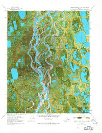
 1970 Beechey Point B-3 SW1971 Print · USGSThe North Slope during the early years of the oil boom is revealed here, documenting the initial industrial infrastructure along Prudhoe Bay. Trace the early logistics of the region through Frontier Camp, the Winter Landing Strip, and the historic Discovery Well Prudhoe Bay State No 1.2 unique versions available
 - 1970 Map of Beechey Point B-2 SE, 1971 Print
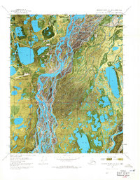
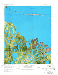
 1970 Beechey Point B-2 SE1971 Print · USGSThe Arctic coastline of Alaska’s North Slope is captured in the early seventies as industrial development began to touch the delta. Trace the remains of Cabins (Ruins) at Point Brower and follow the Winter trail near the delta.3 unique versions available
 - 1970 Map of Beechey Point B-2 SW, 1971 Print
 1970 Beechey Point B-2 SW1971 Print · USGSThe North Slope coast comes into focus in 1970 as industrial exploration begins in the Arctic. Trace the early industrial footprint at Sag Delta No 1 Oil Well and follow the remote Winter trail through the Sagavanirktok River Delta.2 unique versions available
 - 1970 Map of Beechey Point B-3 NW, 1971 Print
 1970 Beechey Point B-3 NW1971 Print · USGSThe Arctic coastline of the North Slope comes into focus during the early 1970s as industrial development began to reach the Beaufort Sea. Local historians can trace early petroleum sites like North Prudhoe State 1 alongside traditional Cabins and the Winter Trail.3 unique versions available
 - 1970 Map of Beechey Point B-3 SE, 1971 Print
 1970 Beechey Point B-3 SE1971 Print · USGSThe Arctic coast of the North Slope is shown here during the initial expansion of the oil industry in the early seventies. Trace the early layout of Prudhoe Bay Airfield, the Prudhoe Dock, and early drilling infrastructure like Drill Site 2.2 unique versions available
 - 1970 Map of Beechey Point B-4 NE, 1971 Print
 1970 Beechey Point B-4 NE1971 Print · USGSThe North Slope coast comes into focus during the early 1970s, showcasing the complex river deltas and barrier islands of the arctic. Researchers can trace the seasonal Winter Trail as it crosses the Kuparuk River and the shores of Gwydyr Bay.2 unique versions available
 - 1970 Map of Beechey Point A-2 NW, 1971 Print
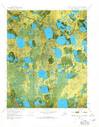
 1970 Beechey Point A-2 NW1971 Print · USGSThe North Slope during the 1970s was a landscape defined by early oil exploration and braided river deltas. Trace the industrial footprint of the era through isolated sites like Kadler State No 1 and the remote Coastal Landing Strip.2 unique versions available
 - 1970 Map of Beechey Point A-2 NE, 1971 Print
 1970 Beechey Point A-2 NE1971 Print · USGSThe Arctic coastline of the North Slope is captured in this 1970 orthophotomap, showing the intricate Sagavanirktok River Delta. Researchers can trace the coastal morphology of Foggy Island Bay and the isolated Foggy Island.2 unique versions available
 - 1971 Map of Sagavanirktok C-2, 1973 Print
 1971 Sagavanirktok C-21973 Print · USGSThe North Slope tundra unfolds in the early seventies, capturing a landscape of seasonal transit and arctic hydrology before extensive industrial development. Researchers can trace the path of the Winter Trail and the winding course of the Shaviovik River.
 - 1971 Map of Philip Smith Mountains A-5, 1973 Print
 1971 Philip Smith Mountains A-51973 Print · USGSThe Brooks Range remains a formidable wilderness in the early seventies, defined by the winding Continental Divide. Researchers can trace the path of the Winter Trail through the Atigun Pass and across the Chandalar Shelf.2 unique versions available
 - 1971 Map of Arctic D-5, 1973 Print
 1971 Arctic D-51973 Print · USGSThe Alaskan North Slope appears in its most isolated state in the early seventies, just before major regional changes. Trace the braided paths of the Ivishak River and Echooka River or locate remote landmarks like Porcupine Lake and Mt Annette.
 - 1971 Map of Sagavanirktok B-4, 1973 Print
 1971 Sagavanirktok B-41973 Print · USGSThe North Slope wilderness comes into focus in the early seventies as surveyors charted the remote tundra. Researchers can trace the seasonal transit routes of the Winter Road and Winter Trail as they parallel the winding Toolik River.
 - 1971 Map of Sagavanirktok C-3, 1973 Print
 1971 Sagavanirktok C-31973 Print · USGSThe North Slope of Alaska appears at the dawn of the oil era in this early 1970s survey. Researchers can trace the braided Sagavanirktok River and locate early exploration markers like the Sag River Oil Well and seasonal Winter Road.3 unique versions available
 - 1971 Map of Chandler Lake A-2, 1973 Print
 1971 Chandler Lake A-21973 Print · USGSThe Brooks Range remains a wilderness of ice and stone in the early 1970s, where the Continental Divide splits the northern and southern watersheds. Researchers can trace the ancient paths of the Anaktuvuk River and find landmarks like Ernie Pass and Cockedhat Mountain.3 unique versions available
 - 1971 Map of Chandalar D-6, 1973 Print
 1971 Chandalar D-61973 Print · USGSThe Brooks Range wilderness of the early seventies is mapped here along the critical Dietrich River corridor. Trace the path of the seasonal Winter Trail and locate landmarks like Table Mountain and Snowden Mountain.3 unique versions available
 - 1971 Map of Sagavanirktok A-1, 1973 Print
 1971 Sagavanirktok A-11973 Print · USGSThe North Slope wilderness in the early seventies shows a landscape of raw river systems and mountain passes. Researchers can trace the braided paths of the Echooka River and Ivishak River or locate the high terrain of Niviak Pass.
 - 1971 Map of Chandler Lake D-1, 1973 Print
 1971 Chandler Lake D-11973 Print · USGSThe North Slope region at the start of the 1970s was a landscape defined by its great waterways and seasonal routes. Researchers and outdoor historians can trace the paths of the Itkillik River, Nanushuk River, and a lonely Winter Trail.
 - 1971 Map of Philip Smith Mountains A-4, 1973 Print
 1971 Philip Smith Mountains A-41973 Print · USGSIn the early 1970s, this remote reach of the Brooks Range was a roadless expanse defined by the Continental Divide. Trace the headwaters of the North Fork Chandalar River across this unsurveyed portion of the Umiat Meridian.2 unique versions available
 - 1971 Map of Philip Smith Mountains D-3, 1973 Print
 1971 Philip Smith Mountains D-31973 Print · USGSThe North Slope landscape in the early seventies reveals the primitive transportation routes and drainage systems of the Arctic. Researchers can trace the seasonal Winter Rd near Oksrukuyik and follow the paths of the Lupine River and Sagavanirktok River.
 - 1971 Map of Philip Smith Mountains C-1, 1973 Print
 1971 Philip Smith Mountains C-11973 Print · USGSThe Brooks Range remains an untouched wilderness during the early seventies, centered on a critical section of the Continental Divide. Researchers can trace the pristine headwaters of the Lupine River, Wind River, and Junjik River through glacial valleys.2 unique versions available
 - 1971 Map of Philip Smith Mountains C-4, 1973 Print
 1971 Philip Smith Mountains C-41973 Print · USGSThe Arctic foothills of the North Slope are captured here in the early 1970s, showing a wilderness landscape at the dawn of modern development. Trace the early transport routes through Atigun Gorge and along the Sagavanirktok River via a seasonal Winter Road.2 unique versions available
Showing maps 1-25 of 77
Top cities of North Slope
- Utqiaġvik historical maps
- Prudhoe Bay historical maps
- Point Hope historical maps
- Wainwright historical maps
- Anaktuvuk Pass historical maps
- Nuiqsut historical maps
See more
Frequently asked questions
- What are the different types of historical maps available for North Slope?
- What is the oldest map of North Slope?
- Where can I purchase historical maps of North Slope for my home or office?
- Where can I download high-res historical maps of North Slope?
- Are there historical topographic maps available for North Slope?
- Is there historical aerial imagery available for North Slope?
- Where are historical maps of North Slope sourced from?