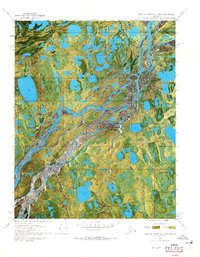
1970 Map of Beechey Point A-2 NW
USGS Topo · Published 1971About this map
The braided channels of the Sagavanirktok River dominate this 1970 orthophotomap, showing the raw industrial expansion on Alaska's North Slope during the early years of oil exploration. This specific quadrangle captures the emerging infrastructure of the Prudhoe Bay era, characterized by isolated drilling sites and support facilities linked by seasonal transportation routes. Notable industrial markers include Kadler State No 1 and Delta State No 1, which represent the early push into the Arctic frontier. The reliance on aviation and seasonal ground transport is evident through the inclusion of the Coastal Landing Strip, Kadler Landing Strip, and a long Winter Trail. This map serves as a primary record of the landscape before more permanent roads and modern developments reshaped the region's coastal plain.
Find a feature on this map
7 named features on this map. Tap any name to fly to it.
Don’t see what you’re looking for? This feature index may not catch every label — zoom into the map to look around manually.
Map Details
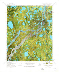
Editions of this 1970 Beechey Point A-2 NW Map
2 editions found
Other maps of this area

1951 · Beechey Point
USGS Topo · 1:250,000

1955 · Beechey Point
USGS Topo · 1:250,000

1955 · Beechey Point B-2
USGS Topo · 1:63,360

1955 · Beechey Point A-2
USGS Topo · 1:63,360

1955 · Beechey Point A-3
USGS Topo · 1:63,360

1955 · Beechey Point B-3
USGS Topo · 1:63,360

1960 · Beechey Point
USGS Topo · 1:250,000

1962 · Beechey Point B-2
USGS Topo · 1:50,000
1962 · Beechey Point A-2
USGS Topo · 1:50,000

1964 · Beechey Point
USGS Topo · 1:250,000