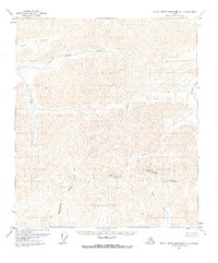
1971 Map of Philip Smith Mountains C-1
USGS Topo · Published 1973About this map
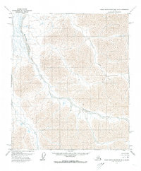
The Continental Divide winds through this high-latitude terrain, marking the hydrological boundary where waters part to flow toward different drainage basins. This 1971 survey captures a landscape defined entirely by its glacial and fluvial systems, with no roads or trails recorded. High-altitude ice fields like Windy Glacier and Seefer Glacier feed the headwaters of several major waterways. The Lupine River and Ribdon River dominate the northern drainage, while the southern slopes give rise to the Wind River and Junjik River. The intricate contouring illustrates the complex alpine topography of the Brooks Range, where the Ivishak River carves deep paths through the mountain massifs. This document preserves the state of these arctic watersheds just as modern photogrammetric mapping was becoming standard for the North Slope.
Find a feature on this map
8 named features on this map. Tap any name to fly to it.
Don’t see what you’re looking for? This feature index may not catch every label — zoom into the map to look around manually.
Map Details
Editions of this 1971 Philip Smith Mountains C-1 Map
2 editions found
Other maps of this area

1951 · Brooks
USGS Topo · 1:250,000

1951 · Arctic
USGS Topo · 1:250,000

1956 · Arctic
USGS Topo · 1:250,000

1956 · Philip Smith Mountains
USGS Topo · 1:250,000

1964 · Philip Smith Mountains
USGS Topo · 1:250,000
1971 · Arctic D-5
USGS Topo · 1:63,360
1971 · Philip Smith Mountains C-2
USGS Topo · 1:63,360
1971 · Philip Smith Mountains D-2
USGS Topo · 1:63,360
1971 · Philip Smith Mountains B-1
USGS Topo · 1:63,360
1971 · Arctic C-5
USGS Topo · 1:63,360