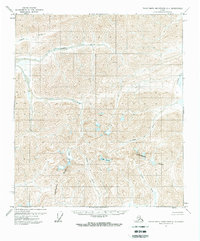
1971 Map of Philip Smith Mountains C-1
USGS Topo · Published 1975About this map
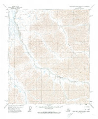
The Continental Divide snake-like path through this high-latitude terrain marks a significant hydrological split in the Brooks Range. Rivers such as the Lupine River and Ribdon River flow north toward the Arctic coastal plain, while the Junjik River originates on the southern side of the crest. This 1971 record, derived from 1970 aerial photography, depicts a landscape devoid of human structures, roads, or trails, highlighting the pure glacial and fluvial geography of the region. The presence of the Windy Glacier and Seefar Glacier nestled in high mountain cirques illustrates the active role of ice in carving these steep valleys. This survey provides a baseline of the permafrost-dominated wilderness before modern industrial or environmental shifts reached these isolated drainages.
Find a feature on this map
14 named features on this map. Tap any name to fly to it.
Don’t see what you’re looking for? This feature index may not catch every label — zoom into the map to look around manually.
Map Details
Editions of this 1971 Philip Smith Mountains C-1 Map
2 editions found
Other maps of this area

1951 · Brooks
USGS Topo · 1:250,000

1951 · Arctic
USGS Topo · 1:250,000

1956 · Arctic
USGS Topo · 1:250,000

1956 · Philip Smith Mountains
USGS Topo · 1:250,000

1964 · Philip Smith Mountains
USGS Topo · 1:250,000
1971 · Arctic D-5
USGS Topo · 1:63,360
1971 · Philip Smith Mountains C-1
USGS Topo · 1:63,360
1971 · Philip Smith Mountains C-2
USGS Topo · 1:63,360
1971 · Philip Smith Mountains D-2
USGS Topo · 1:63,360
1971 · Philip Smith Mountains B-1
USGS Topo · 1:63,360