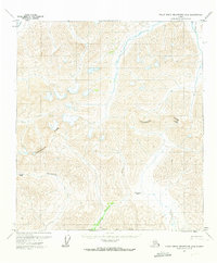
1971 Map of Philip Smith Mountains A-5
USGS Topo · Published 1973About this map
The Continental Divide winds through this high-altitude landscape in the early 1970s, marking the hydrological split of the Brooks Range. This survey captures a critical transition point for transportation and drainage, featuring the high-elevation Atigun Pass and Oolah Pass. The map illustrates the headwaters of several significant North Slope waterways, including the Itkillik R and Kuyuktuvuk Creek, which flow north, while the Dietrich River leads south toward the interior. The presence of a Winter Trail following the river valleys and crossing the Chandalar Shelf highlights the seasonal routes utilized before the extensive modernization of the region's infrastructure. These trails were vital for traversing the difficult terrain between the Brooks Range and the Arctic coastal plain.
Find a feature on this map
9 named features on this map. Tap any name to fly to it.
Don’t see what you’re looking for? This feature index may not catch every label — zoom into the map to look around manually.
Map Details
Editions of this 1971 Philip Smith Mountains A-5 Map
2 editions found
Other maps of this area

1951 · Chandler Lake
USGS Topo · 1:250,000

1951 · Chandalar
USGS Topo · 1:250,000

1951 · Brooks
USGS Topo · 1:250,000

1951 · Wiseman
USGS Topo · 1:250,000

1956 · Chandalar
USGS Topo · 1:250,000

1956 · Wiseman
USGS Topo · 1:250,000

1956 · Philip Smith Mountains
USGS Topo · 1:250,000

1956 · Chandler Lake
USGS Topo · 1:250,000

1964 · Wiseman
USGS Topo · 1:250,000

1964 · Chandalar
USGS Topo · 1:250,000