
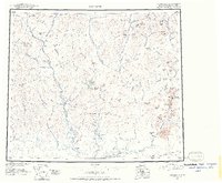
1951 Map of Wiseman
USGS Topo · Published 1952About this map
The remote mining settlements of Wiseman and Nolan anchor this mid-century topographic survey of the Central Brooks Range. This era captures the landscape before the establishment of major highway corridors, when the region was defined by isolated mining camps and scattered cabins along the drainage basins of the John River and Malamute River. The topography is dominated by the Endicott Mountains, featuring prominent peaks such as Mt Doonerak and the sharp Frigid Crags. To the south, the settlement of Coldfoot sits along the Middle Fork, marking a historic waypoint for travelers and prospectors navigating the southern slopes of the Brooks Range. The map reveals a network of pack trails and remote air strips, such as the Landing Area near the confluence of Hunt Fork and the John River, reflecting the airborne and river-based transport patterns of the Alaskan interior during the 1950s.
Find a feature on this map
137 named features on this map. Tap any name to fly to it.
Don’t see what you’re looking for? This feature index may not catch every label — zoom into the map to look around manually.
Map Details
Editions of this 1951 Wiseman Map
2 editions found
Other maps of this area

1951 · Hughes
USGS Topo · 1:250,000

1951 · Bettles
USGS Topo · 1:250,000

1951 · Survey Pass
USGS Topo · 1:250,000

1951 · Chandler Lake
USGS Topo · 1:250,000

1951 · Chandalar
USGS Topo · 1:250,000

1951 · Brooks
USGS Topo · 1:250,000

1951 · Beaver
USGS Topo · 1:250,000

1951 · Killik River
USGS Topo · 1:250,000

1956 · Chandalar
USGS Topo · 1:250,000

1956 · Hughes
USGS Topo · 1:250,000