Loading...
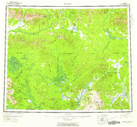
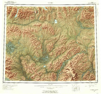
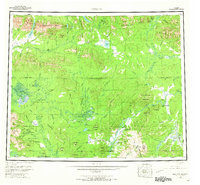
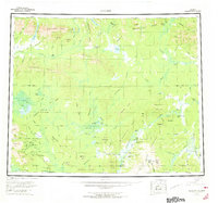
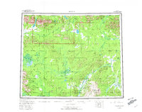
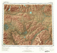
Loading map...1956 Map of Hughes
USGS Topo · Published 1958About this map
The Koyukuk River and Kobuk River systems define this mid-century look at the Alaskan interior, showing a landscape shaped by seasonal travel and subsistence. The village of Hughes serves as the primary hub, surrounded by critical river access points like the Hogatza Landing Area and Elevenmile Landing Area. This 1956 topography documents the historic Potziligi Portage (Kobuk Portage), an ancient overland route connecting the major river basins across the Pah River Flats.
Find a feature on this map
104 named features on this map. Tap any name to fly to it.
Don’t see what you’re looking for? This feature index may not catch every label — zoom into the map to look around manually.
Map Details
Date Portrayed1956
Date Published1958
PublisherU.S. Geological Survey
Map TypeTopographic
Scale1:250,000
Physical Dimensions23.8 x 22.1 inches
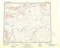
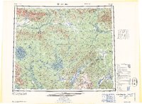
Editions of this 1956 Hughes Map
6 editions found
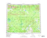
Historical Maps of Hughes Through Time
4 maps found
Featured Locations
Source Details
SourceU.S. Geological Survey
CopyrightPublic Domain