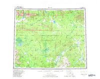
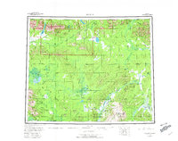
1956 Map of Hughes
USGS Topo · Published 1982About this map
The settlement of Hughes sits at a critical bend in the Koyukuk River, serving as a central point in a landscape defined by dramatic interior Alaska terrain. This mid-century survey documents a region where the Arctic Circle crosses through the Hogatza Hills and the Alatna River valley. To the north, the Gates Of The Arctic National Preserve encompasses the Angayucham Mts and Nutuvukti Lake, while the Koyukuk National Wildlife Refuge stretches across the southwestern corner.
Find a feature on this map
83 named features on this map. Tap any name to fly to it.
Don’t see what you’re looking for? This feature index may not catch every label — zoom into the map to look around manually.
Map Details
Editions of this 1956 Hughes Map
6 editions found

Other maps of this area

1951 · Shungnak
USGS Topo · 1:250,000

1951 · Kateel River
USGS Topo · 1:250,000

1951 · Hughes
USGS Topo · 1:250,000

1951 · Melozitna
USGS Topo · 1:250,000

1951 · Bettles
USGS Topo · 1:250,000

1951 · Survey Pass
USGS Topo · 1:250,000

1951 · Tanana
USGS Topo · 1:250,000

1951 · Ambler River
USGS Topo · 1:250,000

1951 · Wiseman
USGS Topo · 1:250,000

1952 · Melozitna D-1
USGS Topo · 1:63,360