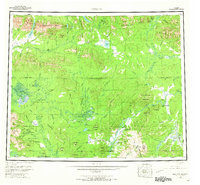
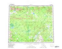
1956 Map of Hughes
USGS Topo · Published 1966About this map
Hughes and its nearby riverside settlements anchor this mid-century survey of the Koyukuk and Kobuk river basins. The landscape is defined by the crossing of the Arctic Circle and the winding path of the Continental Divide, which separates the northern drainage of the Kobuk River from the southern reaches of the Indian River. Human presence is concentrated at aviation and river transport nodes, including Hughes Landing Area and Elevenmile Landing Area, reflecting a period when remote access relied heavily on small aircraft and seasonal waterways.
Find a feature on this map
124 named features on this map. Tap any name to fly to it.
Don’t see what you’re looking for? This feature index may not catch every label — zoom into the map to look around manually.
Map Details
Editions of this 1956 Hughes Map
6 editions found

Other maps of this area

1951 · Shungnak
USGS Topo · 1:250,000

1951 · Kateel River
USGS Topo · 1:250,000

1951 · Hughes
USGS Topo · 1:250,000

1951 · Melozitna
USGS Topo · 1:250,000

1951 · Bettles
USGS Topo · 1:250,000

1951 · Survey Pass
USGS Topo · 1:250,000

1951 · Tanana
USGS Topo · 1:250,000

1951 · Ambler River
USGS Topo · 1:250,000

1951 · Wiseman
USGS Topo · 1:250,000

1952 · Melozitna D-1
USGS Topo · 1:63,360