Old Maps of Northwest Arctic, Alaska
Explore 986 old maps of Northwest Arctic, spanning from 1950 to today. These high-resolution historic maps reveal how streets, neighborhoods, landmarks, and natural features evolved over time — perfect for genealogy, metal detecting, research, and local history exploration.
What you can do with these maps:
- See how Northwest Arctic changed over time: Compare historical maps to modern-day views to trace roads, homesites, rail lines & more.
- View detailed metadata: Each map includes creators, publishers, year, scale, and archive source.
- Overlay maps with satellite & LiDAR: Visualize the past alongside modern tools to explore terrain & human change.
- Trusted historical sources: Maps sourced from the USGS, Library of Congress, and other archives.
- Access maps your way: View online, download high-res files, or order prints for personal or research use.
Start exploring old maps of Northwest Arctic to uncover forgotten places, hidden landmarks, and the deep history beneath your feet.
Northwest Arctic, AK maps
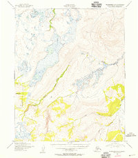
(986)- 1950 Map of Kotzebue A-1
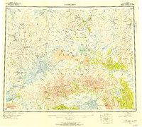
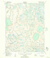
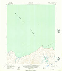 1950 Kotzebue A-11950 Print · USGSThe northern Seward Peninsula coast meets the Arctic waters of Kotzebue Sound in the mid-century. Researchers can trace remote coastal landmarks and drainage patterns including Motherwood Pt, Willow Bay, and a solitary shoreline Cabin.3 unique versions available
 - 1950 Map of Bendeleben C-1, 1955 Print
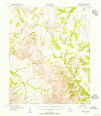
 1950 Bendeleben C-11955 Print · USGSThe Seward Peninsula backcountry comes into focus during the mid-century, revealing a landscape shaped by remote mining and winter travel. Trace the paths of a Winter Trail and Tel Line near Monument Mountain and the water-carrying DITCH lines of Candle Creek.3 unique versions available
 - 1950 Map of Bendeleben C-3, 1955 Print
 1950 Bendeleben C-31955 Print · USGSThe Seward Peninsula in the 1950s reveals a landscape of volcanic cones and hydraulic mining infrastructure. Researchers can trace the path of the Fairhaven Ditch and locate landmarks like Skeleton Butte and Imuruk Lake.2 unique versions available
 - 1950 Map of Bendeleben B-2, 1955 Print
 1950 Bendeleben B-21955 Print · USGSThe Seward Peninsula interior at the mid-century is defined by the high peaks of the Bendeleben Mountains and the winding Koyuk River. Trace the river's path through the rapids and follow northern tributaries like Knowles Creek.3 unique versions available
 - 1950 Map of Bendeleben C-2, 1955 Print
 1950 Bendeleben C-21955 Print · USGSThe Seward Peninsula in the mid-twentieth century reveals the intersection of gold-era infrastructure and the Alaskan wilderness. Map collectors can trace the Fairhaven Ditch past Kettle Dome to a remote cluster of Cabins along the river.3 unique versions available
 - 1950 Map of Bendeleben B-1, 1955 Print
 1950 Bendeleben B-11955 Print · USGSThe Seward Peninsula in the early fifties was a landscape of seasonal routes and untouched wilderness. Trace the Winter Trail as it winds past Kiwalik Mountain and crosses the broad valley of the Koyuk River.2 unique versions available
 - 1950 Map of Bendeleben B-4, 1955 Print
 1950 Bendeleben B-41955 Print · USGSThe Seward Peninsula in the mid-twentieth century reveals a landscape of high peaks and volcanic flows. Geologists and researchers can trace the extent of the Lava beds and the headwaters of the Kuzitrin River and Boston Creek.3 unique versions available
 - 1950 Map of Bendeleben C-4, 1955 Print
 1950 Bendeleben C-41955 Print · USGSThe Bendeleben region of Alaska at the dawn of the 1950s reveals a raw volcanic landscape shaped by ancient flows and river drainages. Researchers can trace the path of the Tractor Trail past Lava Lake and identify distinctive peaks like Andromeda Cone.3 unique versions available
 - 1950 Map of Bendeleben B-3, 1955 Print
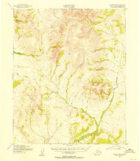
 1950 Bendeleben B-31955 Print · USGSThe Seward Peninsula interior at mid-century reveals a landscape shaped by volcanic forces and the high peaks of the Bendeleben Mountains. Researchers can trace the drainage of the Koyuk River and locate distinct craters like Lost Jim Cone and the Twin Calderas.3 unique versions available
 - 1950 Map of Bendeleben D-2, 1956 Print
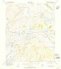
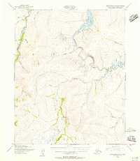 1950 Bendeleben D-21956 Print · USGSRemote Alaskan river valleys on the Seward Peninsula are captured here in the early post-war era, showing a landscape defined by isolation and mineral exploration. Researchers can trace early aviation and mining infrastructure through the Fink Creek Landing Strip, a riverside Gold Mine, and scattered Cabin sites.3 unique versions available
 - 1950 Map of Bendeleben D-5, 1956 Print
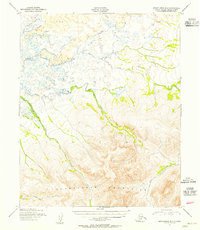
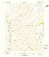
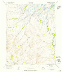 1950 Bendeleben D-51956 Print · USGSThe Seward Peninsula wilderness in the 1950s is revealed here through detailed topographic surveys of the Second Judicial Division. Researchers can trace remote outpost life and water networks like Goodhope River, an isolated Cabin, and Placer Creek.3 unique versions available
 - 1950 Map of Bendeleben, 1956 Print
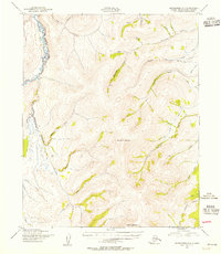
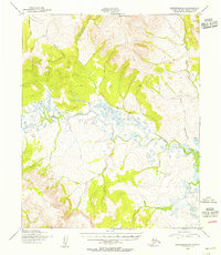
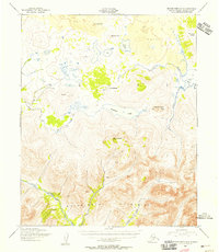
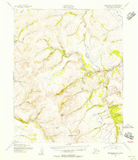
 1950 Bendeleben1956 Print · USGSThe Seward Peninsula in the early fifties shows a rugged interior reliant on aviation and gold mining. Researchers can trace remote outposts like Bunker Hill Station and Aurora or find landing strips at Utica Landing Area.6 unique versions available
 - 1950 Map of Candle C-5, 1956 Print
 1950 Candle C-51956 Print · USGSThe Northwest Arctic interior in the early fifties reveals a remote landscape centered on stream drainages and rudimentary transport. Researchers can locate isolated Cabins and a Landing Strip along the TRACTOR TRAIL that follows Quartz Creek.3 unique versions available
 - 1950 Map of Bendeleben D-3, 1956 Print
 1950 Bendeleben D-31956 Print · USGSThe Seward Peninsula in the early fifties reveals a landscape shaped by remote mineral interests and glacial topography. Researchers can trace the path of the Fairhaven Ditch and locate the Gold Mine near Hannum Creek.2 unique versions available
 - 1950 Map of Bendeleben D-1, 1956 Print
 1950 Bendeleben D-11956 Print · USGSThe Seward Peninsula interior comes into focus during the early 1950s, revealing a landscape defined by resource extraction and remote outposts. Researchers can trace the path of the Tractor Trail or locate early industrial sites like the Coal Mine and Camp 19.3 unique versions available
 - 1950 Map of Candle B-5, 1956 Print
 1950 Candle B-51956 Print · USGSThe Seward Peninsula interior at mid-century was a landscape of remote drainages and gold prospects. Modern researchers can trace the old Tractor Trails connecting a remote Gold Mine to the banks of the Peace River and Sweepstakes Creek.2 unique versions available
 - 1950 Map of Candle B-6, 1956 Print
 1950 Candle B-61956 Print · USGSThe Seward Peninsula interior at mid-century reveals a landscape shaped by natural waterways and high-latitude topography. Researchers can trace the winding course of the Kiwalik River and identify localized drainage points like First Chance Creek and Wilson.2 unique versions available
 - 1950 Map of Candle C-6, 1956 Print
 1950 Candle C-61956 Print · USGSThe Kiwalik River valley is captured here in the mid-1950s, showing a remote Alaskan landscape shaped by seasonal travel and prospecting. Researchers can trace the Winter Trail and Tractor Trail as they connect family-named creeks like Hunter Creek and Gold Creek.2 unique versions available
 - 1950 Map of Bendeleben D-4, 1956 Print
 1950 Bendeleben D-41956 Print · USGSThe Bendeleben region of Alaska's Seward Peninsula appears here in the mid-twentieth century, as mapped from early post-war aerial photography. Researchers can trace the intricate drainages of the Goodhope River, Hoodlum Creek, and Mystery Creek.4 unique versions available
 - 1950 Map of Kotzebue C-5, 1957 Print
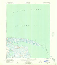
 1950 Kotzebue C-51957 Print · USGSThe Alaskan coast of the Chukchi Sea appears in this mid-century survey as a complex network of tundra lakes and coastal rivers. Researchers can trace the winding paths of the Kitluk River and Espenberg River or locate the Northwest Corner Light.2 unique versions available
 - 1950 Map of Kotzebue B-4, 1957 Print
 1950 Kotzebue B-41957 Print · USGSThe Northwest Arctic shoreline during the mid-twentieth century reveals a landscape defined by seasonal movement and tundra hydrology. Researchers can trace the Winter Trail as it follows the coast of Kotzebue Sound past Kungealoruk Creek.2 unique versions available
 - 1950 Map of Kotzebue B-5, 1957 Print
 1950 Kotzebue B-51957 Print · USGSThe Northwest Arctic coast in the mid-twentieth century reveals a landscape shaped by volcanic geology and seasonal movement. Trace the route of the Winter Trail between Devil Mountain Lakes and a remote lakeside Cabin.2 unique versions available
 - 1950 Map of Kotzebue C-4, 1957 Print
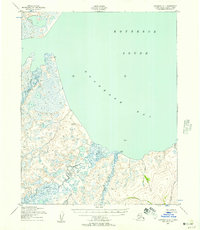
 1950 Kotzebue C-41957 Print · USGSThe Arctic coast of Alaska meets the sea at the turn of the 1950s in this detailed topographic study. Researchers can trace the shifting sands of Cape Espenberg and the mouth of the Espenberg River where it enters the Chukchi Sea.2 unique versions available
 - 1950 Map of Kotzebue A-4, 1957 Print
 1950 Kotzebue A-41957 Print · USGSThe northern coast of the Seward Peninsula appears here in the early fifties, showing a land defined by tide and tundra. Researchers can trace the winding paths of the Goodhope River and Inmachuk River or locate survey markers like VABM Goodhope.3 unique versions available
 - 1950 Map of Kotzebue A-5, 1957 Print
 1950 Kotzebue A-51957 Print · USGSThe Seward Peninsula of Northwest Alaska is shown here in the mid-twentieth century as a landscape of endless water and tundra. Collectors and researchers can trace the winding course of the Nugnualuktuk River and the Lane River alongside geodetic markers like Cactus VABM 77.
Showing maps 1-25 of 986
Top cities of Northwest Arctic
- Kotzebue historical maps
- Selawik historical maps
- Noorvik historical maps
- Noatak historical maps
- Buckland historical maps
- Kiana historical maps
See more
Frequently asked questions
- What are the different types of historical maps available for Northwest Arctic?
- What is the oldest map of Northwest Arctic?
- Where can I purchase historical maps of Northwest Arctic for my home or office?
- Where can I download high-res historical maps of Northwest Arctic?
- Are there historical topographic maps available for Northwest Arctic?
- Is there historical aerial imagery available for Northwest Arctic?
- Where are historical maps of Northwest Arctic sourced from?