
1950 Map of Kotzebue B-4
USGS Topo · Published 1957About this map
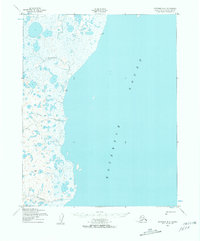
The shoreline of Kotzebue Sound dominates this mid-century topographic record, where the low-lying coastal tundra is defined by a labyrinth of unnamed ponds and marshes. Stretching along the coastline is a critical Winter Trail, providing a clear path of travel through the frozen landscape during the winter months when the watery interior is otherwise impassable. Flowing westward into the sound are Kungealoruk Creek and Kougachuk Creek, which carve distinct drainage patterns through the relatively flat coastal plain. This 1950s study, based on 1949 aerial photography, highlights a period before significant modern development, showing the region as a purely natural environment where movement was dictated by seasonal weather and topography.
Find a feature on this map
4 named features on this map. Tap any name to fly to it.
Don’t see what you’re looking for? This feature index may not catch every label — zoom into the map to look around manually.
Map Details
Editions of this 1950 Kotzebue B-4 Map
2 editions found
Other maps of this area
1950 · Kotzebue C-5
USGS Topo · 1:63,360

1950 · Kotzebue B-5
USGS Topo · 1:63,360
1950 · Kotzebue C-4
USGS Topo · 1:63,360

1950 · Kotzebue A-4
USGS Topo · 1:63,360

1950 · Kotzebue A-5
USGS Topo · 1:63,360

1950 · Kotzebue A-3
USGS Topo · 1:63,360

1951 · Kotzebue
USGS Topo · 1:250,000

1958 · Kotzebue
USGS Topo · 1:250,000

1964 · Kotzebue
USGS Topo · 1:250,000
2014 · Kotzebue C-4 SE
USGS Topo · 1:25,000