
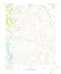
1950 Map of Candle B-6
USGS Topo · Published 1956About this map
The Kiwalik River winds through the eastern portion of this Seward Peninsula landscape, defining the local drainage patterns and topography as they appeared in the early 1950s. Surveyed by the Army Map Service and published by the Geological Survey, this sheet captures a remote interior Alaskan terrain dominated by tributary systems such as First Chance Creek and Wilson. The map reflects a moment in time when aerial photogrammetry was beginning to formalize the mapping of the Alaska-Second Judicial Division, providing a technical look at the land's natural contours before extensive modern change. These watercourses were central to the geographic identity of the region, serving as the primary landmarks in a territory characterized by complex elevational changes and hydrological networks.
Find a feature on this map
3 named features on this map. Tap any name to fly to it.
Don’t see what you’re looking for? This feature index may not catch every label — zoom into the map to look around manually.
Map Details
Editions of this 1950 Candle B-6 Map
2 editions found
Other maps of this area

1950 · Bendeleben C-1
USGS Topo · 1:63,360

1950 · Bendeleben B-1
USGS Topo · 1:63,360

1950 · Bendeleben A-1
USGS Topo · 1:63,360

1950 · Bendeleben
USGS Topo · 1:250,000

1950 · Candle C-5
USGS Topo · 1:63,360

1950 · Candle A-6
USGS Topo · 1:63,360

1950 · Candle B-5
USGS Topo · 1:63,360

1950 · Candle A-5
USGS Topo · 1:63,360

1950 · Candle C-6
USGS Topo · 1:63,360

1951 · Candle
USGS Topo · 1:250,000