
1951 Map of Candle
USGS Topo · Published 1951About this map
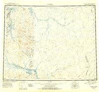
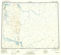
The gold-bearing drainage of the Seward Peninsula is captured here during the post-war era, showing the infrastructure of hydraulic mining and remote aviation. In the northwest, the settlement of Candle serves as a hub near Spafarief Bay, connected to the interior by the extensive Candle Ditch. This man-made waterway, along with numerous smaller ditches near Clem Mountain, highlights the immense effort required to transport water for placer mining operations throughout the region. The landscape is defined by the Kiwalik River and its tributaries, where remote outposts like Snyder Roadhouse and the Mining Camp Airstrip provided essential stops for prospectors and pilots.
Find a feature on this map
88 named features on this map. Tap any name to fly to it.
Don’t see what you’re looking for? This feature index may not catch every label — zoom into the map to look around manually.
Map Details
Editions of this 1951 Candle Map
3 editions found
Other maps of this area

1945 · Nulato
USGS Topo · 1:250,000

1948 · Norton Bay
USGS Topo · 1:250,000

1950 · Kotzebue A-1
USGS Topo · 1:63,360

1950 · Bendeleben C-1
USGS Topo · 1:63,360

1950 · Bendeleben B-1
USGS Topo · 1:63,360

1950 · Bendeleben A-1
USGS Topo · 1:63,360

1950 · Norton Bay D-6
USGS Topo · 1:63,360

1950 · Bendeleben
USGS Topo · 1:250,000

1950 · Candle C-5
USGS Topo · 1:63,360

1950 · Norton Bay D-5
USGS Topo · 1:63,360