
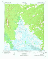
1950 Map of Norton Bay D-6
USGS Topo · Published 1956About this map
The coastal marshlands and river deltas of the Native Reservation dominate this mid-century survey of the Seward Peninsula shoreline. The intricate drainage patterns of the Kwik River and Tubutulik River are captured in high detail, showing a landscape defined by an complex network of sloughs and Tidal Flats where the fresh water meets Norton Bay.
Find a feature on this map
12 named features on this map. Tap any name to fly to it.
Don’t see what you’re looking for? This feature index may not catch every label — zoom into the map to look around manually.
Map Details
Editions of this 1950 Norton Bay D-6 Map
2 editions found
Other maps of this area

1948 · Norton Bay
USGS Topo · 1:250,000

1950 · Bendeleben A-1
USGS Topo · 1:63,360

1950 · Bendeleben
USGS Topo · 1:250,000

1950 · Norton Bay D-5
USGS Topo · 1:63,360

1950 · Solomon C-1
USGS Topo · 1:63,360

1950 · Norton Bay C-6
USGS Topo · 1:63,360

1950 · Solomon D-1
USGS Topo · 1:63,360

1950 · Solomon
USGS Topo · 1:250,000

1950 · Candle A-6
USGS Topo · 1:63,360

1950 · Candle A-5
USGS Topo · 1:63,360